Weststadt | |
|---|---|
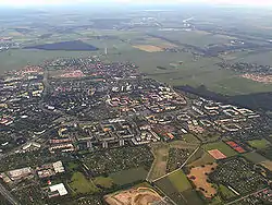 Aerial view of Weststadt | |
 Coat of arms | |
Location of Weststadt within Braunschweig 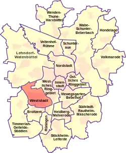 | |
 Weststadt 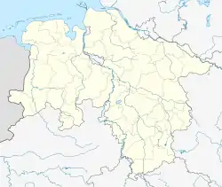 Weststadt | |
| Coordinates: 52°14′56″N 10°29′10″E / 52.24889°N 10.48611°E | |
| Country | Germany |
| State | Lower Saxony |
| District | urban district |
| City | Braunschweig |
| Government | |
| • Mayor | Ulrich Römer (SPD) |
| Area | |
| • Total | 6.793 km2 (2.623 sq mi) |
| Population (2020-12-31)[1] | |
| • Total | 23,298 |
| • Density | 3,400/km2 (8,900/sq mi) |
| Time zone | UTC+01:00 (CET) |
| • Summer (DST) | UTC+02:00 (CEST) |
| Postal codes | 38120 |
| Dialling codes | 0531 |
| Vehicle registration | BS |
| Website | Website |
The Weststadt ("western city") is a Stadtbezirk (borough) in the western part of Braunschweig, Germany.[2] With a population of 23,298 (2020) it is the city's third most populous district.
History and geography
The Weststadt is a planned community, divided into five neighbourhoods. Building of the district started in 1960–61.[3] Also located within the district is the Westpark, a large park and recreational area.[4]
Gallery
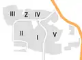 Map of the Weststadt with its five neighbourhoods.
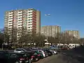 Houses in the Weststadt
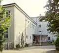 Cultural centre
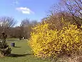 Westpark
Politics
The district mayor Ulrich Römer is a member of the Social Democratic Party of Germany.
References
- ↑ "Einwohnerzahlen nach Stadtbezirken". Stadt Braunschweig. Retrieved 21 September 2021.
- ↑ Stadtbezirke (in German). Retrieved on 1 September 2017.
- ↑ Braunschweig-Weststadt - größtes Wohnbauprojekt in unserer Region (in German). Retrieved on 1 September 2017.
- ↑ Der Westpark (in German). Retrieved on 1 September 2017.
Wikimedia Commons has media related to Weststadt (Braunschweig).
|  | |
This article is issued from Wikipedia. The text is licensed under Creative Commons - Attribution - Sharealike. Additional terms may apply for the media files.