Whippleville, New York | |
|---|---|
 Whippleville, New York  Whippleville, New York | |
| Coordinates: 44°48′35″N 74°15′43″W / 44.80972°N 74.26194°W | |
| Country | United States |
| State | New York |
| County | Franklin |
| Elevation | 823 ft (251 m) |
| Time zone | UTC-5 (Eastern (EST)) |
| • Summer (DST) | UTC-4 (EDT) |
| ZIP code | 12995 |
| Area code(s) | 518 & 838 |
| GNIS feature ID | 971045[1] |
Whippleville is a hamlet in Franklin County, New York, United States. The community is 3.1 miles (5.0 km) south-southeast of Malone. Whippleville had a post office from May 26, 1887, until October 14, 1989; it still has its own ZIP code, 12995.[2][3]
References
- ↑ "Whippleville". Geographic Names Information System. United States Geological Survey, United States Department of the Interior.
- ↑ United States Postal Service. "USPS - Look Up a ZIP Code". Retrieved September 19, 2017.
- ↑ "Postmaster Finder - Post Offices by ZIP Code". United States Postal Service. Retrieved September 19, 2017.
Municipalities and communities of Franklin County, New York, United States | ||
|---|---|---|
| Towns | 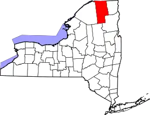 Map of New York highlighting Franklin County | |
| Villages | ||
| CDPs | ||
| Hamlets | ||
| Indian reservation | ||
| Footnotes | ‡This populated place also has portions in an adjacent county or counties | |
This article is issued from Wikipedia. The text is licensed under Creative Commons - Attribution - Sharealike. Additional terms may apply for the media files.