24°15′51.5″N 120°48′1.2″E / 24.264306°N 120.800333°E
Xinshe
新社區 | |
|---|---|
| Xinshe District | |
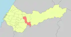 Location in the city | |
| Country | Taiwan |
| Special municipality | Taichung |
| Established (District) | 2010 |
| Area | |
| • Total | 68.8874 km2 (26.5976 sq mi) |
| Population (February 2023) | |
| • Total | 23,256 |
| • Density | 340/km2 (870/sq mi) |
| Time zone | UTC+8 (CST) |
| Website | www |

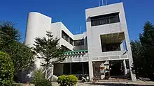
Xinshe District office
Xinshe District library
Xinshe District (Chinese: 新社區; pinyin: Xīnshè Qū) is a rural district in Taichung, Taiwan.[1] It is also called "Taichung's back garden". The city is home to many military bases. However, the district's hillside houses were destroyed by 1999 Chi-Chi earthquake.
Administrative divisions
Danan, Yuehu, Zhongzheng, Zhonghe, Zhongxing, Yongyuan, Dongxing, Xiecheng, Kunshan, Xinshe, Fuxing, Fusheng and Qixi Village.
Education
Senior High School
Native products
Xinshe township fruits: Citrus, Grape, Carambola, Gaojie Pears, Loquats, Mushrooms, Sugar-apple, flowers, Bonsais
Tourist attractions
Transport
- Provincial Highway No.21
- County Road 129 (Shigang - Xinshe - Beitun - Taiping, Taichung City)
References
Wikimedia Commons has media related to Xinshe District, Taichung.
- ↑ Wu, C.; Huang, W. (2014). The Glory of Whampoa: The 90th Anniversary of Whampoa Military Academy. Military History and Translation Division, Administration Office, Ministry of National Defense. p. 193. ISBN 978-986-04-1422-6. Retrieved 17 April 2019.
The 10" Army helped remote mountain elementary schools in Xinshe District, Taichung City, including Dalin, Fumin, Xiecheng, Dongxin and Kunshan, with afterclass counseling.
External links
- Official website
 (in Chinese)
This article is issued from Wikipedia. The text is licensed under Creative Commons - Attribution - Sharealike. Additional terms may apply for the media files.