| Yentna River | |
|---|---|
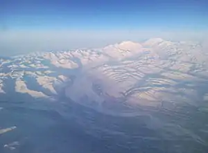 Yentna River in Southcentral Alaska | |
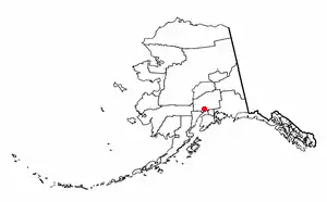
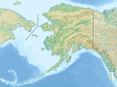 Location of the mouth of the Yentna River in Alaska | |
| Native name | Yentnu (Tanaina) |
| Location | |
| Country | United States of America |
| Physical characteristics | |
| Source | |
| • location | East Fork Yentna River and West Fork Yentna River Matanuska-Susitna Borough, Alaska |
| • coordinates | 62°16′50″N 151°46′26″W / 62.28056°N 151.77389°W[1] |
| • elevation | 200 ft (61 m)[2][3] |
| Mouth | |
• location | Susitna River Matanuska-Susitna Borough, Alaska |
• coordinates | 61°33′38″N 150°29′4″W / 61.56056°N 150.48444°W[1] |
• elevation | 26 ft (7.9 m)[1] |
| Length | 75 mi (121 km)[1] |
The Yentna River[4] (Dena'ina: Yentnu) is a river in South Central Alaska, formed by its East Fork[2] and West Fork[3] at 62°16′50″N 151°46′26″W / 62.28056°N 151.77389°W,[1] flows South-East to Susitna River, 30 miles (48 km) North-West of Anchorage, Alaska; Cook Inlet Low.[1]
History
Tanaina Indian name reported by Spurr (1900, p. 46), United States Geological Survey. "Sometimes called Johnson River after the first white man to ascend it."[1]
Watershed
It begins in the Mount Dall and Yentna glacier systems and flows southeast to the Susitna River 2 miles (3.2 km) north of Susitna. The river system (including upstream tributaries) is about 100 miles (160 km) long.
Tributaries
From mouth to source:
- Kahiltna River 61°51′11″N 150°46′46″W / 61.85306°N 150.77944°W, Elevation: 75 feet (23 m)[5]
- Bottle Creek (Yentna River) 61°57′49″N 151°4′44″W / 61.96361°N 151.07889°W, Elevation: 125 feet (38 m)[6]
- Skwentna River 61°59′8″N 151°8′23″W / 61.98556°N 151.13972°W, Elevation: 125 feet (38 m)[7]
- East Fork Yentna River 62°16′49″N 151°46′26″W / 62.28028°N 151.77389°W, Elevation: 200 feet (61 m)[2]
- West Fork Yentna River 62°16′49″N 151°46′26″W / 62.28028°N 151.77389°W, Elevation: 200 feet (61 m)[3]
Lake Creek just about 8 miles down river from Bottle Creek. Major fishing area: kings, reds, silvers. Winter sports, hunting. Moose Creek, Indian Creek, Fish lakes Creek, Hewitt Creek, Malone's Slough, Donkey Creek, Johnson Creek, Clearwater Creek, Rich Creek, Flag Creek, Delta Creek, Fourth of July Creek, & Kichatna River round out the rest of the main Yentna River Tributaries.
See also
References
- 1 2 3 4 5 6 7 "Yentna River". Geographic Names Information System. United States Geological Survey, United States Department of the Interior. Retrieved 2009-05-03.
- 1 2 3 "East Fork Yetna River". Geographic Names Information System. United States Geological Survey, United States Department of the Interior. Retrieved 2009-05-03.
- 1 2 3 "West Fork Yetna River". Geographic Names Information System. United States Geological Survey, United States Department of the Interior. Retrieved 2009-05-03.
- ↑ United States Geological Survey Hydrological Unit Code:
- ↑ "Kahiltna River". Geographic Names Information System. United States Geological Survey, United States Department of the Interior. Retrieved 2009-05-03.
- ↑ "Bottle Creek (Yentna River)". Geographic Names Information System. United States Geological Survey, United States Department of the Interior. Retrieved 2009-05-03.
- ↑ "Skwentna River". Geographic Names Information System. United States Geological Survey, United States Department of the Interior. Retrieved 2009-05-03.