Zennewijnen | |
|---|---|
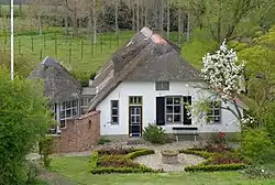 Farm in Zennewijnen | |
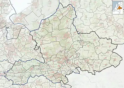 Zennewijnen Location in the Netherlands  Zennewijnen Zennewijnen (Netherlands) | |
| Coordinates: 51°51′32″N 5°24′35″E / 51.85889°N 5.40972°E | |
| Country | Netherlands |
| Province | Gelderland |
| Municipality | Tiel |
| Area | |
| • Total | 2.90 km2 (1.12 sq mi) |
| Elevation | 6 m (20 ft) |
| Population | |
| • Total | 145 |
| • Density | 50/km2 (130/sq mi) |
| Time zone | UTC+1 (CET) |
| • Summer (DST) | UTC+2 (CEST) |
| Postal code | 4062[1] |
| Dialing code | 0344 |
Zennewijnen is a hamlet in the Dutch province of Gelderland. It is a part of the municipality of Tiel, and lies about 3 km south of Tiel.
It was first mentioned in 850 as Sinuinum. The etymology in unclear.[3] The Premonstratensian monastery Mariënschoot was located near Zennewijnen since the 13th century and a site for pilgrimage. In 1372, the monastery burnt down and was demolished in 1572. In 1840, it was home to 171 people. There is a still a brickworks in Zennewijnen.[4]
Gallery
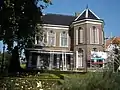 Villa in Zennwijnen
 Country side
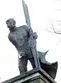 The rower statue by Willem den Ouden
References
- 1 2 3 "Kerncijfers wijken en buurten 2021". Central Bureau of Statistics. Retrieved 24 March 2022.
two entries
- ↑ "Postcodetool for 4062PL". Actueel Hoogtebestand Nederland (in Dutch). Het Waterschapshuis. Retrieved 24 March 2022.
- ↑ "Zennewijnen - (geografische naam)". Etymologiebank (in Dutch). Retrieved 24 March 2022.
- ↑ "Zennewijnen". Plaatsengids (in Dutch). Retrieved 24 March 2022.
This article is issued from Wikipedia. The text is licensed under Creative Commons - Attribution - Sharealike. Additional terms may apply for the media files.