Étalleville | |
|---|---|
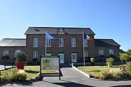 The town hall in Étalleville | |
Location of Étalleville | |
 Étalleville  Étalleville | |
| Coordinates: 49°44′20″N 0°49′32″E / 49.7389°N 0.8256°E | |
| Country | France |
| Region | Normandy |
| Department | Seine-Maritime |
| Arrondissement | Rouen |
| Canton | Yvetot |
| Intercommunality | CC Plateau de Caux-Doudeville-Yerville |
| Government | |
| • Mayor (2020–2026) | Clotilde Colley[1] |
| Area 1 | 3.55 km2 (1.37 sq mi) |
| Population | 433 |
| • Density | 120/km2 (320/sq mi) |
| Time zone | UTC+01:00 (CET) |
| • Summer (DST) | UTC+02:00 (CEST) |
| INSEE/Postal code | 76251 /76560 |
| Elevation | 107–152 m (351–499 ft) (avg. 131 m or 430 ft) |
| 1 French Land Register data, which excludes lakes, ponds, glaciers > 1 km2 (0.386 sq mi or 247 acres) and river estuaries. | |
Étalleville (French pronunciation: [etalvil]) is a commune in the Seine-Maritime department in the Normandy region in northern France.
Geography
A farming village situated in the Pays de Caux, some 20 miles (32 km) southwest of Dieppe at the junction of the D149 and the D89 road.
Population
| Year | Pop. | ±% p.a. |
|---|---|---|
| 1968 | 184 | — |
| 1975 | 234 | +3.49% |
| 1982 | 383 | +7.29% |
| 1990 | 371 | −0.40% |
| 1999 | 364 | −0.21% |
| 2007 | 418 | +1.74% |
| 2012 | 447 | +1.35% |
| 2017 | 454 | +0.31% |
| Source: INSEE[3] | ||
Places of interest
- The church of St. Gratien, dating from the nineteenth century.
See also
References
- ↑ "Répertoire national des élus: les maires" (in French). data.gouv.fr, Plateforme ouverte des données publiques françaises. 13 September 2022.
- ↑ "Populations légales 2021". The National Institute of Statistics and Economic Studies. 28 December 2023.
- ↑ Population en historique depuis 1968, INSEE
Wikimedia Commons has media related to Étalleville.
This article is issued from Wikipedia. The text is licensed under Creative Commons - Attribution - Sharealike. Additional terms may apply for the media files.