Amage | |
|---|---|
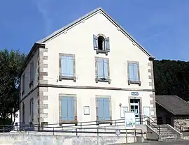 The town hall in Amage | |
 Coat of arms | |
Location of Amage | |
 Amage  Amage | |
| Coordinates: 47°50′15″N 6°29′37″E / 47.8375°N 6.4936°E | |
| Country | France |
| Region | Bourgogne-Franche-Comté |
| Department | Haute-Saône |
| Arrondissement | Lure |
| Canton | Mélisey |
| Government | |
| • Mayor (2023–2026) | Pascal Thouvenot[1] |
| Area 1 | 6.54 km2 (2.53 sq mi) |
| Population | 309 |
| • Density | 47/km2 (120/sq mi) |
| Time zone | UTC+01:00 (CET) |
| • Summer (DST) | UTC+02:00 (CEST) |
| INSEE/Postal code | 70011 /70280 |
| Elevation | 334–560 m (1,096–1,837 ft) |
| 1 French Land Register data, which excludes lakes, ponds, glaciers > 1 km2 (0.386 sq mi or 247 acres) and river estuaries. | |
Amage (French pronunciation: [amaʒ]) is a commune in the Haute-Saône department in the region of Bourgogne-Franche-Comté in eastern France.
It is the site of the ancient Magetobria, known for the Battle of Magetobriga.[3]
See also
References
- ↑ "Répertoire national des élus: les maires" (in French). data.gouv.fr, Plateforme ouverte des données publiques françaises. 6 June 2023.
- ↑ "Populations légales 2021". The National Institute of Statistics and Economic Studies. 28 December 2023.
- ↑ Lund University. Digital Atlas of the Roman Empire.
Wikimedia Commons has media related to Amage.
This article is issued from Wikipedia. The text is licensed under Creative Commons - Attribution - Sharealike. Additional terms may apply for the media files.