Granges-le-Bourg | |
|---|---|
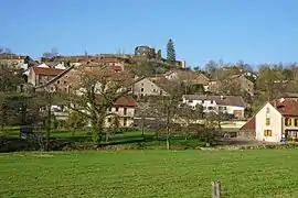 A general view of Granges-le-Bourg | |
 Coat of arms | |
Location of Granges-le-Bourg | |
 Granges-le-Bourg  Granges-le-Bourg | |
| Coordinates: 47°33′56″N 6°35′11″E / 47.5656°N 6.5864°E | |
| Country | France |
| Region | Bourgogne-Franche-Comté |
| Department | Haute-Saône |
| Arrondissement | Lure |
| Canton | Villersexel |
| Government | |
| • Mayor (2020–2026) | Claude Armbruster[1] |
| Area 1 | 10.35 km2 (4.00 sq mi) |
| Population | 381 |
| • Density | 37/km2 (95/sq mi) |
| Time zone | UTC+01:00 (CET) |
| • Summer (DST) | UTC+02:00 (CEST) |
| INSEE/Postal code | 70277 /70400 |
| Elevation | 290–453 m (951–1,486 ft) |
| 1 French Land Register data, which excludes lakes, ponds, glaciers > 1 km2 (0.386 sq mi or 247 acres) and river estuaries. | |
Granges-le-Bourg (French pronunciation: [ɡʁɑ̃ʒ lə buʁ]) is a commune in the Haute-Saône department in the region of Bourgogne-Franche-Comté in eastern France.
Population
|
| |||||||||||||||||||||||||||||||||||||||||||||||||||||||||||||||||||||||||||||||||||||||||||||||||||||||||||||||
| Source: EHESS[3] and INSEE (1968-2017)[4] | ||||||||||||||||||||||||||||||||||||||||||||||||||||||||||||||||||||||||||||||||||||||||||||||||||||||||||||||||
See also
References
- ↑ "Répertoire national des élus: les maires" (in French). data.gouv.fr, Plateforme ouverte des données publiques françaises. 13 September 2022.
- ↑ "Populations légales 2021". The National Institute of Statistics and Economic Studies. 28 December 2023.
- ↑ Des villages de Cassini aux communes d'aujourd'hui: Commune data sheet Granges-le-Bourg, EHESS (in French).
- ↑ Population en historique depuis 1968, INSEE
Wikimedia Commons has media related to Granges-le-Bourg.
This article is issued from Wikipedia. The text is licensed under Creative Commons - Attribution - Sharealike. Additional terms may apply for the media files.