Anthy-sur-Léman | |
|---|---|
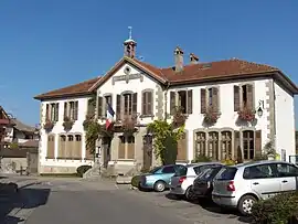 The town hall in Anthy-sur-Léman | |
 Coat of arms | |
Location of Anthy-sur-Léman | |
 Anthy-sur-Léman  Anthy-sur-Léman | |
| Coordinates: 46°21′21″N 6°25′39″E / 46.3558°N 6.4275°E | |
| Country | France |
| Region | Auvergne-Rhône-Alpes |
| Department | Haute-Savoie |
| Arrondissement | Thonon-les-Bains |
| Canton | Sciez |
| Intercommunality | Thonon Agglomération |
| Government | |
| • Mayor (2020–2026) | Isabelle Asni-Duchêne[1] |
| Area 1 | 4.62 km2 (1.78 sq mi) |
| Population | 2,327 |
| • Density | 500/km2 (1,300/sq mi) |
| Demonym | Anthychois / Anthychoise |
| Time zone | UTC+01:00 (CET) |
| • Summer (DST) | UTC+02:00 (CEST) |
| INSEE/Postal code | 74013 /74200 |
| Elevation | 372–470 m (1,220–1,542 ft) |
| 1 French Land Register data, which excludes lakes, ponds, glaciers > 1 km2 (0.386 sq mi or 247 acres) and river estuaries. | |
Anthy-sur-Léman (French pronunciation: [ɑ̃ti syʁ lemɑ̃], literally Anthy on Léman) is a commune in the Haute-Savoie department in the Auvergne-Rhône-Alpes region in south-eastern France.
Population
| Year | Pop. | ±% p.a. |
|---|---|---|
| 1968 | 579 | — |
| 1975 | 896 | +6.44% |
| 1982 | 1,121 | +3.25% |
| 1990 | 1,383 | +2.66% |
| 1999 | 1,767 | +2.76% |
| 2007 | 1,900 | +0.91% |
| 2012 | 2,012 | +1.15% |
| 2017 | 2,171 | +1.53% |
| Source: INSEE[3] | ||
See also
References
- ↑ "Répertoire national des élus: les maires" (in French). data.gouv.fr, Plateforme ouverte des données publiques françaises. 13 September 2022.
- ↑ "Populations légales 2021". The National Institute of Statistics and Economic Studies. 28 December 2023.
- ↑ Population en historique depuis 1968, INSEE
Wikimedia Commons has media related to Anthy-sur-Léman.
This article is issued from Wikipedia. The text is licensed under Creative Commons - Attribution - Sharealike. Additional terms may apply for the media files.