Aubencheul-au-Bac | |
|---|---|
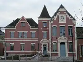 The town hall in Aubencheul-au-Bac | |
_Nord-France.svg.png.webp) Coat of arms | |
Location of Aubencheul-au-Bac | |
 Aubencheul-au-Bac  Aubencheul-au-Bac | |
| Coordinates: 50°15′27″N 3°09′38″E / 50.2575°N 3.1606°E | |
| Country | France |
| Region | Hauts-de-France |
| Department | Nord |
| Arrondissement | Cambrai |
| Canton | Cambrai |
| Intercommunality | CA Cambrai |
| Government | |
| • Mayor (2020–2026) | Michel Prettre[1] |
| Area 1 | 3.2 km2 (1.2 sq mi) |
| Population | 538 |
| • Density | 170/km2 (440/sq mi) |
| Time zone | UTC+01:00 (CET) |
| • Summer (DST) | UTC+02:00 (CEST) |
| INSEE/Postal code | 59023 /59265 |
| Elevation | 33–79 m (108–259 ft) |
| 1 French Land Register data, which excludes lakes, ponds, glaciers > 1 km2 (0.386 sq mi or 247 acres) and river estuaries. | |
Aubencheul-au-Bac (French pronunciation: [obɑ̃ʃœl o bak]) is a commune in the Nord department in northern France.[3]
Population
| Year | Pop. | ±% p.a. |
|---|---|---|
| 1968 | 367 | — |
| 1975 | 396 | +1.09% |
| 1982 | 440 | +1.52% |
| 1990 | 516 | +2.01% |
| 1999 | 480 | −0.80% |
| 2009 | 478 | −0.04% |
| 2014 | 501 | +0.94% |
| 2020 | 544 | +1.38% |
| Source: INSEE[4] | ||
Heraldry
Arms of Aubencheul-au-Bac |
The arms of Aubencheul-au-Bac are blazoned : Gules, 2 fesses within and conjoined to a bordure Or.
|
See also
References
- ↑ "Répertoire national des élus: les maires". data.gouv.fr, Plateforme ouverte des données publiques françaises (in French). 2 December 2020.
- ↑ "Populations légales 2021". The National Institute of Statistics and Economic Studies. 28 December 2023.
- ↑ INSEE commune file
- ↑ Population en historique depuis 1968, INSEE
Wikimedia Commons has media related to Aubencheul-au-Bac.
This article is issued from Wikipedia. The text is licensed under Creative Commons - Attribution - Sharealike. Additional terms may apply for the media files.