| Aubrey Hills | |
|---|---|
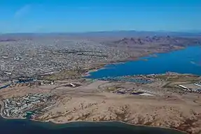 View southeast. The dark Aubrey Hills are adjacent the east side of Lake Havasu, southeast of Lake Havasu City. (expandable photo) | |
| Highest point | |
| Peak | Peak 1537, southeast, near terminus |
| Elevation | 1,537 ft (468 m) |
| Dimensions | |
| Length | 16 mi (26 km) NW-SE |
| Width | 4.5 mi (7.2 km) |
| Geography | |
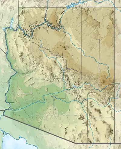 Aubrey Hills in Arizona | |
| Country | United States |
| State | Arizona |
| Regions | Mojave Desert and Sonoran Desert |
| County | Mohave |
| Communities | Lake Havasu City and Parker Dam |
| Range coordinates | 34°19′N 114°6′W / 34.317°N 114.100°W |
| Borders on | Colorado River, Lake Havasu, Mohave Mountains, Bill Williams Mountains and Bill Williams River |
The Aubrey Hills in Arizona in the Lower Colorado River Valley corridor are a small, lower elevation, craggy mountain range bordering the southeast side of Lake Havasu. The range is about 16-mi (26 km) long trending exactly northwest-by-southeast.
The southeast terminus of the range contains its highpoint, Peak 1537, 1,537 feet (468 m);[1] the southeast end of the range also borders the short, west-flowing Bill Williams River. The moderate height mountains that parallel the range eastward is the Bill Williams Mountains.
References
External links
 Media related to Aubrey Hills at Wikimedia Commons
- Peakbagger.com: Range Coordinates, and highpoint, Peak 1537
This article is issued from Wikipedia. The text is licensed under Creative Commons - Attribution - Sharealike. Additional terms may apply for the media files.