| Fremont Peak | |
|---|---|
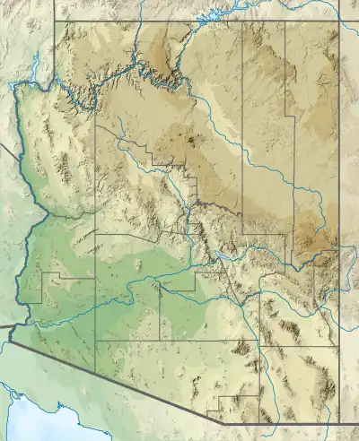
 Doyle Peak and Fremont Peak (right) from the eastern side of Agassiz Peak | |
| Highest point | |
| Elevation | 11,973 ft (3,649 m) NAVD 88[1] |
| Prominence | 615 ft (187 m)[1] |
| Parent peak | Agassiz Peak[1] |
| Coordinates | 35°19′23″N 111°39′40″W / 35.3230643°N 111.6609943°W[2] |
| Geography | |
 Fremont Peak | |
| Location | Coconino County, Arizona, U.S. |
| Parent range | San Francisco Peaks |
| Topo map | USGS Humphreys Peak |
| Geology | |
| Volcanic field | San Francisco volcanic field |
| Climbing | |
| Easiest route | From Doyle Saddle |
Fremont Peak is a peak in the San Francisco Peaks, a mountain range that takes up a part of the Coconino National Forest in northern Arizona. It is the third highest point in the state of Arizona,[1] and named in honor John C. Frémont (1813–1890), an explorer and civil war general, who served as the governor of Arizona Territory from 1878 to 1882.[3] The peak is in the Kachina Peaks Wilderness on the Coconino National Forest.
Fremont offers year-round views of the south. It can be seen from Flagstaff, Arizona as the pointy peak on the right.
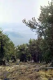
View through a grove of Rocky Mountain Bristlecone Pine growing on the south slope of Fremont Peak, Flagstaff is visible in the background
See also
References
- 1 2 3 4 "Fremont Peak, Arizona". Peakbagger.com. Retrieved 2009-01-10.
- ↑ "Fremont Peak". Geographic Names Information System. United States Geological Survey, United States Department of the Interior. Retrieved 2009-01-10.
- ↑ "History of the San Francisco Peaks and how they got their names". US Forest Service. Archived from the original on 24 February 2023. Retrieved 16 November 2023.
External links
- "Fremont Peak". SummitPost.org.
Wikimedia Commons has media related to Fremont Peak.
This article is issued from Wikipedia. The text is licensed under Creative Commons - Attribution - Sharealike. Additional terms may apply for the media files.