Aulhat-Flat | |
|---|---|
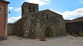 The church in Flat | |
Location of Aulhat-Flat | |
 Aulhat-Flat  Aulhat-Flat | |
| Coordinates: 45°34′16″N 3°18′11″E / 45.571°N 3.303°E | |
| Country | France |
| Region | Auvergne-Rhône-Alpes |
| Department | Puy-de-Dôme |
| Arrondissement | Issoire |
| Canton | Issoire |
| Intercommunality | Agglo Pays d'Issoire |
| Government | |
| • Mayor (2020–2026) | Gérard Thevier[1] |
| Area 1 | 12.78 km2 (4.93 sq mi) |
| Population | 932 |
| • Density | 73/km2 (190/sq mi) |
| Time zone | UTC+01:00 (CET) |
| • Summer (DST) | UTC+02:00 (CEST) |
| INSEE/Postal code | 63160 /63500 |
| 1 French Land Register data, which excludes lakes, ponds, glaciers > 1 km2 (0.386 sq mi or 247 acres) and river estuaries. | |
Aulhat-Flat (French pronunciation: [oja fla]) is a commune in the Puy-de-Dôme department of central France. The municipality was established on 1 January 2016 and consists of the former communes of Aulhat-Saint-Privat and Flat.[3]
See also
References
Wikimedia Commons has media related to Aulhat-Flat.
- ↑ "Répertoire national des élus: les maires" (in French). data.gouv.fr, Plateforme ouverte des données publiques françaises. 4 May 2022.
- ↑ "Populations légales 2021". The National Institute of Statistics and Economic Studies. 28 December 2023.
- ↑ Arrêté préfectoral Archived 2015-12-08 at the Wayback Machine 18 November 2015 (in French)
This article is issued from Wikipedia. The text is licensed under Creative Commons - Attribution - Sharealike. Additional terms may apply for the media files.