Aurahua | |
|---|---|
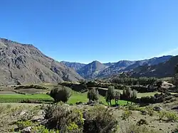 Mountains and fields in the Aurahua District | |
| Country | |
| Region | Huancavelica |
| Province | Castrovirreyna |
| Founded | September 6, 1920 |
| Capital | Aurahua |
| Area | |
| • Total | 360.97 km2 (139.37 sq mi) |
| Elevation | 3,470 m (11,380 ft) |
| Population | |
| • Total | 2,353 |
| • Density | 6.5/km2 (17/sq mi) |
| Time zone | UTC-5 (PET) |
| UBIGEO | 090403 |
Aurahua District is one of thirteen districts of the Castrovirreyna Province in Peru.[1]
References
- ↑ (in Spanish) Instituto Nacional de Estadística e Informática. Banco de Información Distrital Archived April 23, 2008, at the Wayback Machine. Retrieved April 11, 2008.
| |
|---|---|
| Acobamba | |
| Angaraes | |
| Castrovirreyna | |
| Churcampa | |
| Huancavelica | |
| Huaytará | |
| Tayacaja | |
This article is issued from Wikipedia. The text is licensed under Creative Commons - Attribution - Sharealike. Additional terms may apply for the media files.