Bacilly | |
|---|---|
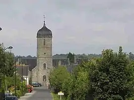 Village view | |
Location of Bacilly | |
 Bacilly  Bacilly | |
| Coordinates: 48°42′06″N 1°26′23″W / 48.7017°N 1.4397°W | |
| Country | France |
| Region | Normandy |
| Department | Manche |
| Arrondissement | Avranches |
| Canton | Avranches |
| Intercommunality | CA Mont-Saint-Michel-Normandie |
| Government | |
| • Mayor (2020–2026) | Eric Quinton[1] |
| Area 1 | 15.88 km2 (6.13 sq mi) |
| Population | 949 |
| • Density | 60/km2 (150/sq mi) |
| Time zone | UTC+01:00 (CET) |
| • Summer (DST) | UTC+02:00 (CEST) |
| INSEE/Postal code | 50027 /50530 |
| Elevation | 7–75 m (23–246 ft) (avg. 14 m or 46 ft) |
| 1 French Land Register data, which excludes lakes, ponds, glaciers > 1 km2 (0.386 sq mi or 247 acres) and river estuaries. | |
Bacilly is a commune in the Manche department in the Normandy region in northwestern France.
Population
| Year | Pop. | ±% p.a. |
|---|---|---|
| 1968 | 781 | — |
| 1975 | 691 | −1.73% |
| 1982 | 673 | −0.38% |
| 1990 | 644 | −0.55% |
| 1999 | 670 | +0.44% |
| 2007 | 785 | +2.00% |
| 2012 | 900 | +2.77% |
| 2017 | 935 | +0.77% |
| Source: INSEE[3] | ||
See also
References
- ↑ "Répertoire national des élus: les maires". data.gouv.fr, Plateforme ouverte des données publiques françaises (in French). 9 August 2021.
- ↑ "Populations légales 2021". The National Institute of Statistics and Economic Studies. 28 December 2023.
- ↑ Population en historique depuis 1968, INSEE
Wikimedia Commons has media related to Bacilly.
This article is issued from Wikipedia. The text is licensed under Creative Commons - Attribution - Sharealike. Additional terms may apply for the media files.