Saint-Clément-Rancoudray | |
|---|---|
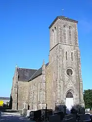 The church of Saint-Clément | |
Location of Saint-Clément-Rancoudray | |
 Saint-Clément-Rancoudray  Saint-Clément-Rancoudray | |
| Coordinates: 48°40′30″N 0°53′06″W / 48.675°N 0.885°W | |
| Country | France |
| Region | Normandy |
| Department | Manche |
| Arrondissement | Avranches |
| Canton | Le Mortainais |
| Intercommunality | CA Mont-Saint-Michel-Normandie |
| Government | |
| • Mayor (2020–2026) | Jean-Paul Brionne[1] |
| Area 1 | 32.1 km2 (12.4 sq mi) |
| Population | 547 |
| • Density | 17/km2 (44/sq mi) |
| Time zone | UTC+01:00 (CET) |
| • Summer (DST) | UTC+02:00 (CEST) |
| INSEE/Postal code | 50456 /50140 |
| Elevation | 225–321 m (738–1,053 ft) (avg. 315 m or 1,033 ft) |
| 1 French Land Register data, which excludes lakes, ponds, glaciers > 1 km2 (0.386 sq mi or 247 acres) and river estuaries. | |
Saint-Clément-Rancoudray (French pronunciation: [sɛ̃ klemɑ̃ ʁɑ̃kudʁɛ]) is a commune in the Manche department in Normandy in north-western France.[3]
See also
References
- ↑ "Répertoire national des élus: les maires". data.gouv.fr, Plateforme ouverte des données publiques françaises (in French). 2 December 2020.
- ↑ "Populations légales 2021". The National Institute of Statistics and Economic Studies. 28 December 2023.
- ↑ INSEE commune file
Wikimedia Commons has media related to Saint-Clément-Rancoudray.
This article is issued from Wikipedia. The text is licensed under Creative Commons - Attribution - Sharealike. Additional terms may apply for the media files.