Bakhuizen
Bakhuzen | |
|---|---|
Village | |
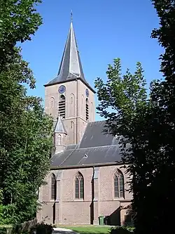 Bakhuizen Church | |
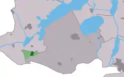 Location in De Friese Meren municipality | |
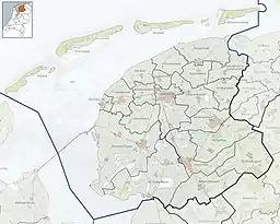 Bakhuizen Location in the Netherlands  Bakhuizen Bakhuizen (Netherlands) | |
| Coordinates: 52°52′6″N 5°27′30″E / 52.86833°N 5.45833°E | |
| Country | |
| Province | |
| Municipality | |
| Area | |
| • Total | 2.91 km2 (1.12 sq mi) |
| Elevation | 7 m (23 ft) |
| Population (2021)[1] | |
| • Total | 1,045 |
| • Density | 360/km2 (930/sq mi) |
| Postal code | 8574[1] |
| Dialing code | 0514 |
| Website | Official |
Bakhuizen (West Frisian: Bakhuzen) is a village in the Dutch province of Friesland. It is in the municipality De Fryske Marren, about 6 km east of the city of Stavoren.
Bakhuizen has about 1,075 inhabitants.[3]
History
The village was first mentioned in 1412 as Backhuysen. The etymology is unclear.[4] Bakhuizen developed in the 12th or 13th century on a clay ridge. Even though it belonged to Mirns, it developed independently and became a Catholic enclave.[5] The first church was built in 1412. After the Reformation, the villagers used a clandestine church in Elfbergen and the wind mill Mole Polle.[6] The Catholic St.-Odulphus Church was built between 1913 and 1914.[5] In 1840, it was home to 477 people.[6]
References
- 1 2 3 "Kerncijfers wijken en buurten 2021". Central Bureau of Statistics. Retrieved 29 March 2022.
- ↑ "Postcodetool for 8574RA". Actueel Hoogtebestand Nederland (in Dutch). Het Waterschapshuis. Retrieved 29 March 2022.
- ↑ Kerncijfers wijken en buurten 2017 - CBS
- ↑ "Bakhuizen - (geografische naam)". Etymologiebank (in Dutch). Retrieved 29 March 2022.
- 1 2 Ronald Stenvert & Sabine Broekhoven (2000). "Bakhuizen" (in Dutch). Zwolle: Waanders. ISBN 90 400 9476 4. Retrieved 29 March 2022.
- 1 2 "Bakhuizen". Plaatsengids (in Dutch). Retrieved 29 March 2022.
External links
![]() Media related to Bakhuizen at Wikimedia Commons
Media related to Bakhuizen at Wikimedia Commons