Scharsterbrug
Skarsterbrêge | |
|---|---|
Village | |
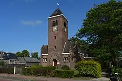 Scharsterbrug church | |
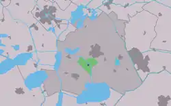 Location in the former Skarsterlân municipality | |
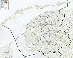 Scharsterbrug Location in the Netherlands  Scharsterbrug Scharsterbrug (Netherlands) | |
| Coordinates: 52°56′35″N 5°46′47″E / 52.94306°N 5.77972°E | |
| Country | |
| Province | |
| Municipality | |
| Area | |
| • Total | 6.87 km2 (2.65 sq mi) |
| Elevation | 0.0 m (0.0 ft) |
| Population (2021)[1] | |
| • Total | 805 |
| • Density | 120/km2 (300/sq mi) |
| Postal code | 8517[1] |
| Dialing code | 0513 |
Scharsterbrug (West Frisian: Skarsterbrêge) is a village in De Fryske Marren in the province of Friesland, the Netherlands. It had a population of around 830 in 2017.[3]
There is a restored windmill, De Skarrenmolen.
History
The village was first mentioned in 1847 as Scharsterbrug, and the means bridge over the canal running through the Scharren (communal ground).[4] In 1580, the Scharsterrijn was dug for peat excavation in the Scharren. In 1840, it was home to 147 people. In 1911, a dairy factory was constructed and in 1914, a church was built.[5] The Skarrenmoune is a polder mill which was probably built in 1881.[6]
Before 2014, Scharsterbrug was part of the Skarsterlân municipality and before 1984 it was part of Doniawerstal.[5]
Gallery
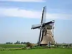 Skarrenmolen
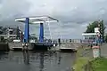 Bridge of Scharsterbrug
References
- 1 2 3 "Kerncijfers wijken en buurten 2021". Central Bureau of Statistics. Retrieved 30 March 2022.
- ↑ "Postcodetool for 8517DC". Actueel Hoogtebestand Nederland (in Dutch). Het Waterschapshuis. Retrieved 29 March 2022.
- ↑ Kerncijfers wijken en buurten 2017 - CBS
- ↑ "Scharsterbrug - (geografische naam)". Etymologiebank (in Dutch). Retrieved 30 March 2022.
- 1 2 "Scharsterburg". Plaatsengids (in Dutch). Retrieved 30 March 2022.
- ↑ "De Skarrenmoune". Molen database (in Dutch). Retrieved 30 March 2022.
External links
![]() Media related to Scharsterbrug at Wikimedia Commons
Media related to Scharsterbrug at Wikimedia Commons