Idskenhuizen
Jiskenhuzen | |
|---|---|
Village | |
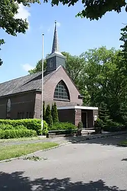 Idskenhuizen church | |
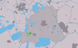 Location in the former Skarsterlân municipality | |
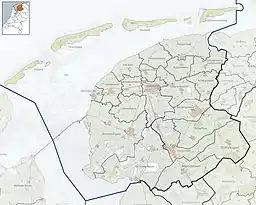 Idskenhuizen Location in the Netherlands  Idskenhuizen Idskenhuizen (Netherlands) | |
| Coordinates: 52°55′43″N 5°42′48″E / 52.92861°N 5.71333°E | |
| Country | |
| Province | |
| Municipality | |
| Area | |
| • Total | 2.31 km2 (0.89 sq mi) |
| Elevation | 0.6 m (2.0 ft) |
| Population (2021)[1] | |
| • Total | 490 |
| • Density | 210/km2 (550/sq mi) |
| Postal code | 8523[1] |
| Dialing code | 0513 |
Idskenhuizen (West Frisian: Jiskenhuzen) is a village in De Fryske Marren municipality in the province of Friesland, the Netherlands. It had a population of around 480 in 2017.[3]
History
The village as first mentioned in 1495 as Eesken hwsen, and means "settlement of Eesk/Eeske (person)".[4] Around 1500, the villa Roordastins was located near the village. In 1840, it was home to 296 people. The Protestant church dates from 1889, and is a replacement of an earlier church.[5]
Before 2014, Idskenhuizen was part of the Skarsterlân municipality and before 1984 it was part of Doniawerstal.[5]
Gallery
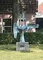 Art in Idskenhuizen
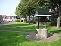 Well in Idskenhuizen
References
- 1 2 3 "Kerncijfers wijken en buurten 2021". Central Bureau of Statistics. Retrieved 29 March 2022.
- ↑ "Postcodetool for 8523DK". Actueel Hoogtebestand Nederland (in Dutch). Het Waterschapshuis. Retrieved 29 March 2022.
- ↑ Kerncijfers wijken en buurten 2017 - CBS
- ↑ "Idskenhuizen - (geografische naam)". Etymologiebank (in Dutch). Retrieved 29 March 2022.
- 1 2 "Idskenhuizen". Plaatsengids (in Dutch). Retrieved 29 March 2022.
External links
![]() Media related to Idskenhuizen at Wikimedia Commons
Media related to Idskenhuizen at Wikimedia Commons
This article is issued from Wikipedia. The text is licensed under Creative Commons - Attribution - Sharealike. Additional terms may apply for the media files.