Cartelle | |
|---|---|
municipality | |
 Seal | |
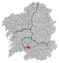 Location in Galicia | |
 Cartelle Location in Spain | |
| Coordinates: 42°14′57″N 8°04′08″W / 42.24917°N 8.06889°W | |
| Country | |
| Autonomous community | |
| Province | |
| Comarca | Terra de Celanova |
| Government | |
| • Mayor | María del Carmen Leyte Coello (People's Party) |
| Area | |
| • Total | 94.3 km2 (36.4 sq mi) |
| Elevation | 356 m (1,168 ft) |
| Population (2018)[2] | |
| • Total | 2,643 |
| • Density | 28/km2 (73/sq mi) |
| Time zone | UTC+1 (CET) |
| • Summer (DST) | UTC+2 (CEST) |
| INE municipality code | 32020 |
Cartelle is a municipality in Ourense (province) in the Galicia region of north-west Spain.
References
- ↑ "IGE. Táboas". www.ige.eu (in Galician). Retrieved 2017-10-07.
- ↑ Municipal Register of Spain 2018. National Statistics Institute.
This article is issued from Wikipedia. The text is licensed under Creative Commons - Attribution - Sharealike. Additional terms may apply for the media files.