Cortegada | |
|---|---|
municipality | |
 Seal | |
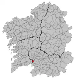 Location in Galicia | |
 Cortegada Location in Spain | |
| Coordinates: 42°12′25″N 8°10′09″W / 42.20694°N 8.16917°W | |
| Country | |
| Autonomous community | |
| Province | |
| Comarca | O Ribeiro |
| Area | |
| • Total | 26.9 km2 (10.4 sq mi) |
| Elevation | 146 m (479 ft) |
| Population (2018)[2] | |
| • Total | 1,105 |
| • Density | 41/km2 (110/sq mi) |
| Time zone | UTC+1 (CET) |
| • Summer (DST) | UTC+2 (CEST) |
| INE municipality code | 32027 |
Cortegada is a municipality in the Ourense, Galicia, Spain. It has a population of 1,407 (2004) and an area of 27 km2 (10 sq mi). It contains the abandoned hamlet of A Barca.
References
- ↑ "IGE. Táboas". www.ige.eu (in Galician). Retrieved 2017-10-07.
- ↑ Municipal Register of Spain 2018. National Statistics Institute.
This article is issued from Wikipedia. The text is licensed under Creative Commons - Attribution - Sharealike. Additional terms may apply for the media files.