| Chaba Peak | |
|---|---|
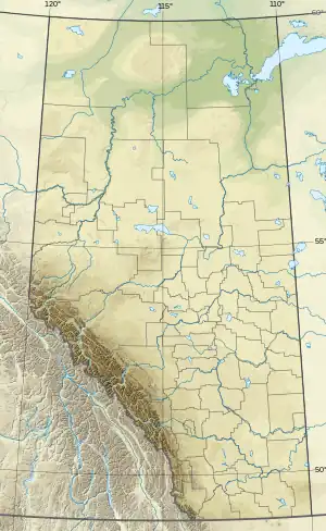 Chaba Peak Location on Alberta/British Columbia boundary 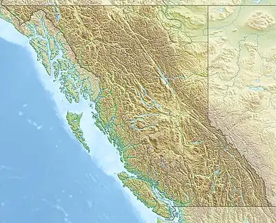 Chaba Peak Chaba Peak (British Columbia) | |
| Highest point | |
| Elevation | 3,212 m (10,538 ft)[1][2] |
| Prominence | 278 m (912 ft)[3] |
| Parent peak | Apex Mountain (3250 m)[3] |
| Listing | |
| Coordinates | 52°11′52″N 117°40′18″W / 52.1977778°N 117.6716667°W[4] |
| Geography | |
| Country | Canada |
| Provinces | Alberta and British Columbia |
| District | Kootenay Land District[5] |
| Parent range | Chaba Icefield Park Ranges |
| Topo map | NTS 83C4 Clemenceau Icefield[4] |
| Climbing | |
| First ascent | 1928 by E. Schoeller and Julius Rahmi (guide)[1][6] |
Chaba Peak is located in the Chaba Icefield south of Fortress Lake in Hamber Provincial Park on the Continental Divide marking the Alberta-British Columbia border.[5] It was named in 1920 after the Chaba River by the Interprovincial Boundary Survey.[5] Chaba is the Stoney Indian word for beaver.[1][3]
See also
References
- 1 2 3 "Chaba Peak". cdnrockiesdatabases.ca. Retrieved 2019-08-11.
- ↑ "Topographic map of Chaba Peak". opentopomap.org. Retrieved 2023-08-17.
- 1 2 3 "False Chaba Peak". Bivouac.com. Retrieved 2021-08-15.
- 1 2 "Chaba Peak (Alberta)". Geographical Names Data Base. Natural Resources Canada. Retrieved 2021-08-15.
- 1 2 3 "Chaba Peak". BC Geographical Names. Retrieved 2023-08-17.
- ↑ North, Francis (1937). "Ascents Along the Athabaska". American Alpine Journal. American Alpine Club. Retrieved 2023-08-17.
This article is issued from Wikipedia. The text is licensed under Creative Commons - Attribution - Sharealike. Additional terms may apply for the media files.