Chalindrey | |
|---|---|
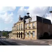 The town hall in Chalindrey | |
.svg.png.webp) Coat of arms | |
Location of Chalindrey | |
 Chalindrey  Chalindrey | |
| Coordinates: 47°48′13″N 5°25′42″E / 47.8036°N 5.4283°E | |
| Country | France |
| Region | Grand Est |
| Department | Haute-Marne |
| Arrondissement | Langres |
| Canton | Chalindrey |
| Intercommunality | CC des Savoir-Faire |
| Government | |
| • Mayor (2020–2026) | Jean-Pierre Garnier[1] |
| Area 1 | 20.03 km2 (7.73 sq mi) |
| Population | 2,377 |
| • Density | 120/km2 (310/sq mi) |
| Time zone | UTC+01:00 (CET) |
| • Summer (DST) | UTC+02:00 (CEST) |
| INSEE/Postal code | 52093 /52600 |
| Elevation | 274–471 m (899–1,545 ft) (avg. 350 m or 1,150 ft) |
| 1 French Land Register data, which excludes lakes, ponds, glaciers > 1 km2 (0.386 sq mi or 247 acres) and river estuaries. | |
Chalindrey (French pronunciation: [ʃalɛ̃dʁɛ]) is a commune in the Haute-Marne department in north-eastern France. Culmont-Chalindrey station is an important railway junction.
Population
| Year | Pop. | ±% p.a. |
|---|---|---|
| 1968 | 3,495 | — |
| 1975 | 3,383 | −0.46% |
| 1982 | 3,149 | −1.02% |
| 1990 | 2,824 | −1.35% |
| 1999 | 2,699 | −0.50% |
| 2007 | 2,706 | +0.03% |
| 2012 | 2,503 | −1.55% |
| 2017 | 2,407 | −0.78% |
| Source: INSEE[3] | ||
See also
References
- ↑ "Répertoire national des élus: les maires" (in French). data.gouv.fr, Plateforme ouverte des données publiques françaises. 13 September 2022.
- ↑ "Populations légales 2021". The National Institute of Statistics and Economic Studies. 28 December 2023.
- ↑ Population en historique depuis 1968, INSEE
Wikimedia Commons has media related to Chalindrey.
This article is issued from Wikipedia. The text is licensed under Creative Commons - Attribution - Sharealike. Additional terms may apply for the media files.