Chhatoh | |
|---|---|
Village | |
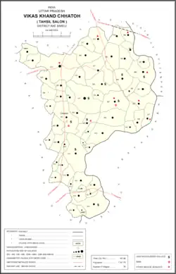 Map of Chhatoh CD block | |
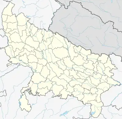 Chhatoh Location in Uttar Pradesh, India | |
| Coordinates: 26°09′48″N 81°31′06″E / 26.163419°N 81.518467°E[1] | |
| Country India | |
| State | Uttar Pradesh |
| District | Raebareli |
| Area | |
| • Total | 6.067 km2 (2.342 sq mi) |
| Population (2011)[2] | |
| • Total | 3,999 |
| • Density | 660/km2 (1,700/sq mi) |
| Languages | |
| • Official | Hindi |
| Time zone | UTC+5:30 (IST) |
| PIN | 229307[2] |
| Vehicle registration | UP-35 |
Chhatoh is a village and corresponding community development block in Salon tehsil of Rae Bareli district, Uttar Pradesh, India.[2] It is located 43 km from Raebareli, the district headquarters.[3] As of 2011, Chhatoh has a population of 3,999 people, in 749 households.[2] It has 3 primary schools and one veterinary hospital but no healthcare facilities for humans.[2] In addition to being the block headquarters, Chhatoh is also the headquarters of a nyaya panchayat that includes 8 other villages.[4]
The 1951 census recorded Chhatoh as comprising 10 hamlets, with a total population of 1,386 people (682 male and 704 female), in 343 households and 341 physical houses.[5] The area of the village was given as 1,569 acres.[5] 28 residents were literate, 26 male and 2 female.[5] The village was listed as belonging to the pargana of Rokha and the thana of Mustafabad.[5]
The 1961 census recorded Chhatoh as comprising 14 hamlets, with a total population of 1,569 people (770 male and 799 female), in 396 households and 359 physical houses.[6] The area of the village was given as 1,569 acres and it had access to electricity at that point.[6]
The 1981 census recorded Chhatoh as having a population of 2,060 people, in 581 households, and having an area of 613.51 hectares.[3] The main staple foods were listed as wheat and rice.[3]
The 1991 census recorded Chhatoh as having a total population of 2,527 people (1,250 male and 1,277 female), in 556 households and 556 physical houses.[4] The area of the village was listed as 613 hectares.[4] Members of the 0-6 age group numbered 518, or 20.5% of the total; this group was 50% male (257) and 50% female (261).[4] Members of scheduled castes made up 40.4% of the village's population, while no members of scheduled tribes were recorded.[4] The literacy rate of the village was 19% (415 men and 63 women).[4] 765 people were classified as main workers (662 men and 103 women), while 277 people were classified as marginal workers (3 men and 274 women); the remaining 1,485 residents were non-workers.[4] The breakdown of main workers by employment category was as follows: 574 cultivators (i.e. people who owned or leased their own land); 149 agricultural labourers (i.e. people who worked someone else's land in return for payment); 0 workers in livestock, forestry, fishing, hunting, plantations, orchards, etc.; 0 in mining and quarrying; 2 household industry workers; 2 workers employed in other manufacturing, processing, service, and repair roles; 0 construction workers; 3 employed in trade and commerce; 0 employed in transport, storage, and communications; and 35 in other services.[4]
Villages
Chhatoh CD block has the following 58 villages:[2]
| Village name | Total land area (hectares) | Population (in 2011) |
|---|---|---|
| Jamalpr Hurayya | 187.4 | 1,363 |
| Mahmadpur Namaksar | 260.4 | 1,580 |
| Nasirabad | 937.9 | 13,648 |
| Bedhauna | 184 | 1,392 |
| Alampur | 184 | 0 |
| Kunwar Mau | 736.7 | 5,184 |
| Hari Rampur Tirra | 70 | 502 |
| Barkhurdarpur | 177.1 | 1,642 |
| Kazipur Teliyani | 414.4 | 3,248 |
| Sarain | 254.2 | 1,776 |
| Kolwa | 342.8 | 2,224 |
| Ashrafpur | 512.5 | 4,918 |
| Lahenga | 515.6 | 3,297 |
| Bheliya | 454.8 | 3,000 |
| Kanta | 338.1 | 2,004 |
| Hajipur | 172.1 | 1,080 |
| Bani | 170.2 | 1,682 |
| Tarapur | 161.6 | 1,010 |
| Kurha | 555.8 | 3,412 |
| Digha | 463.5 | 1,536 |
| Itraura | 182.3 | 670 |
| Abdu Mau | 288.2 | 1,339 |
| Sandaha | 593.6 | 4,145 |
| Paraiya Namaksar | 529.4 | 4,506 |
| Basanpur | 426.1 | 3,678 |
| Rajiyapur | 171.5 | 957 |
| Pure Rae | 192.5 | 1,607 |
| Makhdoompur | 252.5 | 1,318 |
| Lakhapur | 232.4 | 2,490 |
| Kondari | 139.6 | 1,182 |
| Kukha | 284.7 | 1,643 |
| Chaturpur | 151.5 | 1,618 |
| Basupur | 128.2 | 902 |
| Kapoorpur | 567 | 1,615 |
| Chhatoh (block headquarters) | 606.7 | 3,999 |
| Medapur | 211.6 | 1,728 |
| Garha | 342.7 | 2,060 |
| Kanakpur | 477.6 | 599 |
| Chandawahipur | 226.4 | 1,045 |
| Pichhwariya | 103.7 | 648 |
| Sarai Doola | 89.3 | 586 |
| Gopalipur | 132.5 | 886 |
| Jagatpur | 175.2 | 792 |
| Bhuwalpur Sisni | 739.6 | 3,291 |
| Bishesherpur | 42.9 | 369 |
| Sujwariya | 171.6 | 863 |
| Bewal | 711.7 | 2,781 |
| Sulaipur | 83.2 | 665 |
| Padumpur | 214.2 | 1,585 |
| Dhanapur | 36.8 | 695 |
| Barawan | 287.1 | 1,391 |
| Dostpur Burhwara | 61.5 | 1,006 |
| Birpur | 34.4 | 493 |
| Ninawan | 43.6 | 1,077 |
| Pachhuwa Bara | 29.6 | 647 |
| Bara | 523.2 | 3,578 |
| Mahanandpur | 115.2 | 590 |
| Bhagawantpur | 63.7 | 461 |
References
- ↑ "Geographic Names Search WebApp". Do a radial search using these coordinates here.
- 1 2 3 4 5 6 7 "Census of India 2011: Uttar Pradesh District Census Handbook - Rae Bareli, Part A (Village and Town Directory)" (PDF). Census 2011 India. pp. 410–26. Retrieved 29 August 2021.
- 1 2 3 Census 1981 Uttar Pradesh: District Census Handbook Part XIII-A: Village & Town Directory, District Rae Bareli (PDF). 1982. pp. 206–7. Retrieved 29 August 2021.
- 1 2 3 4 5 6 7 8 Census 1991 Series-25 Uttar Pradesh Part-XII B Village & Townwise Primary Census Abstract District Census Handbook District Raebareli (PDF). 1992. pp. xxiv–xxviii, 254–5. Retrieved 11 October 2021.
- 1 2 3 4 Census of India, 1951: District Census Handbook Uttar Pradesh (42 - Rae Bareli District) (PDF). Allahabad. 1955. pp. 160–1. Retrieved 11 October 2021.
{{cite book}}: CS1 maint: location missing publisher (link) - 1 2 Census 1961: District Census Handbook, Uttar Pradesh (39 - Raebareli District) (PDF). Lucknow. 1965. pp. cii-ciii of section "Salon Tahsil". Retrieved 29 August 2021.
{{cite book}}: CS1 maint: location missing publisher (link)