Cognac-la-Forêt | |
|---|---|
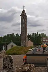 The Lanterne des Morts, in Cognac-la-Forêt | |
.svg.png.webp) Coat of arms | |
Location of Cognac-la-Forêt | |
 Cognac-la-Forêt  Cognac-la-Forêt | |
| Coordinates: 45°50′05″N 1°00′40″E / 45.8347°N 1.0111°E | |
| Country | France |
| Region | Nouvelle-Aquitaine |
| Department | Haute-Vienne |
| Arrondissement | Rochechouart |
| Canton | Rochechouart |
| Government | |
| • Mayor (2020–2026) | Christian Vignerie[1] |
| Area 1 | 31.56 km2 (12.19 sq mi) |
| Population | 1,198 |
| • Density | 38/km2 (98/sq mi) |
| Time zone | UTC+01:00 (CET) |
| • Summer (DST) | UTC+02:00 (CEST) |
| INSEE/Postal code | 87046 /87310 |
| Elevation | 171–418 m (561–1,371 ft) |
| 1 French Land Register data, which excludes lakes, ponds, glaciers > 1 km2 (0.386 sq mi or 247 acres) and river estuaries. | |
Cognac-la-Forêt (French pronunciation: [kɔɲak la fɔʁɛ]; Occitan: Conhac la Forest) is a commune in the Haute-Vienne department in the Nouvelle-Aquitaine region in western France.
See also
References
- ↑ "Répertoire national des élus: les maires". data.gouv.fr, Plateforme ouverte des données publiques françaises (in French). 2 December 2020.
- ↑ "Populations légales 2021". The National Institute of Statistics and Economic Studies. 28 December 2023.
Wikimedia Commons has media related to Cognac-la-Forêt.
This article is issued from Wikipedia. The text is licensed under Creative Commons - Attribution - Sharealike. Additional terms may apply for the media files.