Saint-Paul | |
|---|---|
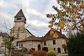 The church in Saint-Paul | |
.svg.png.webp) Coat of arms | |
Location of Saint-Paul | |
 Saint-Paul  Saint-Paul | |
| Coordinates: 45°45′03″N 1°25′59″E / 45.7508°N 1.4331°E | |
| Country | France |
| Region | Nouvelle-Aquitaine |
| Department | Haute-Vienne |
| Arrondissement | Limoges |
| Canton | Condat-sur-Vienne |
| Government | |
| • Mayor (2020–2026) | Josiane Rouchut[1] |
| Area 1 | 37.39 km2 (14.44 sq mi) |
| Population | 1,230 |
| • Density | 33/km2 (85/sq mi) |
| Time zone | UTC+01:00 (CET) |
| • Summer (DST) | UTC+02:00 (CEST) |
| INSEE/Postal code | 87174 /87260 |
| Elevation | 276–460 m (906–1,509 ft) |
| 1 French Land Register data, which excludes lakes, ponds, glaciers > 1 km2 (0.386 sq mi or 247 acres) and river estuaries. | |
Saint-Paul (French pronunciation: [sɛ̃ pɔl] ⓘ; Occitan: Sent Paul) is a commune in the Haute-Vienne department in the Nouvelle-Aquitaine region in west-central France.
Inhabitants are known as Saint-Paulais.
See also
References
- ↑ "Répertoire national des élus: les maires". data.gouv.fr, Plateforme ouverte des données publiques françaises (in French). 2 December 2020.
- ↑ "Populations légales 2021". The National Institute of Statistics and Economic Studies. 28 December 2023.
Wikimedia Commons has media related to Saint-Paul (Haute-Vienne).
This article is issued from Wikipedia. The text is licensed under Creative Commons - Attribution - Sharealike. Additional terms may apply for the media files.