Drumhirk
| |
|---|---|
_-_geograph.org.uk_-_2998836.jpg.webp) Drumhirk Fields 2012 | |
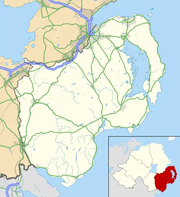 Drumhirk Location within County Down | |
| Area | 0.805 sq mi (2.08 km2) |
| Irish grid reference | J4617766123 |
| • Belfast | 8.5 mi (13.7 km) |
| District | |
| County | |
| Country | Northern Ireland |
| Sovereign state | United Kingdom |
| Post town | NEWTOWNARDS |
| Postcode district | BT23 |
| Dialling code | 028 |
| Police | Northern Ireland |
| Fire | Northern Ireland |
| Ambulance | Northern Ireland |
| UK Parliament | |
| NI Assembly | |
Drumhirk (from Irish: Droim Thoirc, meaning "ridge of the wild boar"[1]) is a rural townland between Ballygowan and Comber in County Down, Northern Ireland. It has an area of 515.2 acres (2.085 km2). It is situated in the civil parish of Kilmood,[2] the Poor Law Union of Newtownards and the historic barony of Castlereagh Lower. Located 2 miles south of Comber, it lies within the Electoral Division of Newtownards North which is part of the Ards and North Down Borough Council.[3]
See also
References
- ↑ "Place Names NI Drumhirk". experience.arcgis.com. Retrieved 18 November 2023.
- ↑ "Kilmood townlands". freepages.rootsweb.com. Retrieved 18 November 2023.
- ↑ "Townlands.ie County Down Townlands, Drumhirk". 18 November 2023.
This article is issued from Wikipedia. The text is licensed under Creative Commons - Attribution - Sharealike. Additional terms may apply for the media files.