Fargues | |
|---|---|
Part of Porte-du-Quercy | |
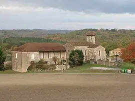 The church of Farguettes | |
Location of Fargues | |
 Fargues  Fargues | |
| Coordinates: 44°23′59″N 1°10′56″E / 44.3997°N 1.1822°E | |
| Country | France |
| Region | Occitania |
| Department | Lot |
| Arrondissement | Cahors |
| Canton | Luzech |
| Commune | Porte-du-Quercy |
| Area 1 | 14.79 km2 (5.71 sq mi) |
| Population (2019)[1] | 153 |
| • Density | 10/km2 (27/sq mi) |
| Time zone | UTC+01:00 (CET) |
| • Summer (DST) | UTC+02:00 (CEST) |
| Postal code | 46800 |
| Elevation | 155–289 m (509–948 ft) (avg. 266 m or 873 ft) |
| 1 French Land Register data, which excludes lakes, ponds, glaciers > 1 km2 (0.386 sq mi or 247 acres) and river estuaries. | |
Fargues (French pronunciation: [faʁɡ]; Languedocien: Fargas) is a former commune in the Lot department in south-western France. On 1 January 2019, it was merged into the new commune Porte-du-Quercy.[2]
Geography
The Séoune forms part of the commune's southern border.
See also
References
- ↑ Téléchargement du fichier d'ensemble des populations légales en 2019, INSEE
- ↑ Arrêté préfectoral 28 September 2018 (in French)
Wikimedia Commons has media related to Fargues (Lot).
This article is issued from Wikipedia. The text is licensed under Creative Commons - Attribution - Sharealike. Additional terms may apply for the media files.