Ferreruela de Huerva | |
|---|---|
 Ferreruela de Huerva | |
| Coordinates: 41°4′N 1°14′W / 41.067°N 1.233°W | |
| Country | Spain |
| Autonomous community | Aragon |
| Province | Teruel |
| Comarca | Jiloca |
| Area | |
| • Total | 20.47 km2 (7.90 sq mi) |
| Elevation | 1,018 m (3,340 ft) |
| Population (2018)[1] | |
| • Total | 63 |
| • Density | 3.1/km2 (8.0/sq mi) |
| Time zone | UTC+1 (CET) |
| • Summer (DST) | UTC+2 (CEST) |
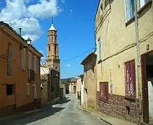
Street in Ferreruela
Ferreruela de Huerva, or simply Ferreruela, is a municipality located in the Jiloca Comarca, province of Teruel, Aragon, Spain. According to the 2010 census,[2] the municipality has a population of 74 inhabitants.
Ferreruela is located in the Sierra de Cucalón area and it is named after the Huerva River.
See also
References
- ↑ Municipal Register of Spain 2018. National Statistics Institute.
- ↑ Instituto Nacional de Estadística (Spain)
Wikimedia Commons has media related to Ferreruela de Huerva.
This article is issued from Wikipedia. The text is licensed under Creative Commons - Attribution - Sharealike. Additional terms may apply for the media files.