Florenville
Floravile (Gaumais) | |
|---|---|
City and municipality | |
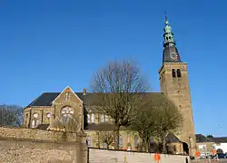 Church of Our Lady of the Assumption | |
.svg.png.webp) Coat of arms | |
Location of Florenville | |
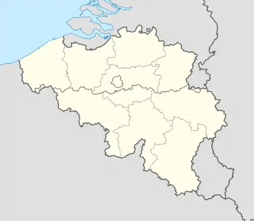 Florenville Location in Belgium
Location of Florenville in Luxembourg province 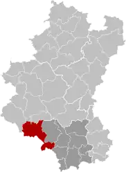 | |
| Coordinates: 49°41.9′N 5°18.6′E / 49.6983°N 5.3100°E | |
| Country | |
| Community | French Community |
| Region | Wallonia |
| Province | Luxembourg |
| Arrondissement | Virton |
| Government | |
| • Mayor | Caroline Godfrin (MR, Ambition Commune) |
| • Governing party/ies | Ambition commune - Vivr'ensemble |
| Area | |
| • Total | 148.07 km2 (57.17 sq mi) |
| Population (2018-01-01)[1] | |
| • Total | 5,629 |
| • Density | 38/km2 (98/sq mi) |
| Postal codes | 6820-6824 |
| NIS code | 85011 |
| Area codes | 061 |
| Website | www.florenville.be |
.jpg.webp)
Walking trails in Gaume Natural Park
Florenville (French pronunciation: [flɔʁɑ̃vil] ⓘ; Gaumais: Floravile) is a city and municipality of Wallonia located in the province of Luxembourg, Belgium.
On 1 January 2016 the municipality had 5,639 inhabitants. The total area is 146.91 km², giving a population density of 38.38 inhabitants per km².
It is located on the Semois River, facing the French border.
The municipality consists of the following districts: Chassepierre, Florenville, Fontenoille, Lacuisine, Muno, Sainte-Cécile, and Villers-devant-Orval.
Other population centers include: Azy, Conques, Laiche, Martué, Lambermont, Le Ménil, and Watrinsart.
Orval Abbey is located in Villers-devant-Orval.
See also
References
- Union des Villes et Communes Wallones (in French)
- SPF Economy (in French)
External links
 Media related to Florenville at Wikimedia Commons
- Florenville official website (in French)
Places adjacent to Florenville | ||||||||||||||||
|---|---|---|---|---|---|---|---|---|---|---|---|---|---|---|---|---|
| ||||||||||||||||
Municipalities of the province of Luxembourg, Wallonia | ||
|---|---|---|
| Arlon |  | |
| Bastogne | ||
| Marche-en-Famenne | ||
| Neufchâteau | ||
| Virton | ||
Bold indicates cities | ||
- ↑ "Wettelijke Bevolking per gemeente op 1 januari 2018". Statbel. Retrieved 9 March 2019.
This article is issued from Wikipedia. The text is licensed under Creative Commons - Attribution - Sharealike. Additional terms may apply for the media files.