Fort-Moville | |
|---|---|
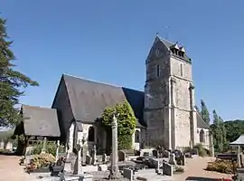 The church in Fort-Moville | |
 Coat of arms | |
Location of Fort-Moville | |
 Fort-Moville  Fort-Moville | |
| Coordinates: 49°20′03″N 0°25′11″E / 49.3342°N 0.4197°E | |
| Country | France |
| Region | Normandy |
| Department | Eure |
| Arrondissement | Bernay |
| Canton | Beuzeville |
| Government | |
| • Mayor (2020–2026) | Philippe Marmion[1] |
| Area 1 | 9.32 km2 (3.60 sq mi) |
| Population | 518 |
| • Density | 56/km2 (140/sq mi) |
| Time zone | UTC+01:00 (CET) |
| • Summer (DST) | UTC+02:00 (CEST) |
| INSEE/Postal code | 27258 /27210 |
| Elevation | 38–142 m (125–466 ft) (avg. 60 m or 200 ft) |
| 1 French Land Register data, which excludes lakes, ponds, glaciers > 1 km2 (0.386 sq mi or 247 acres) and river estuaries. | |
Fort-Moville is a commune in the Eure department in the Normandy region in northern France.
Population
| Year | Pop. | ±% |
|---|---|---|
| 1962 | 202 | — |
| 1968 | 266 | +31.7% |
| 1975 | 241 | −9.4% |
| 1982 | 244 | +1.2% |
| 1990 | 261 | +7.0% |
| 1999 | 312 | +19.5% |
| 2008 | 381 | +22.1% |
See also
References
- ↑ "Répertoire national des élus: les maires". data.gouv.fr, Plateforme ouverte des données publiques françaises (in French). 2 December 2020.
- ↑ "Populations légales 2021". The National Institute of Statistics and Economic Studies. 28 December 2023.
Wikimedia Commons has media related to Fort-Moville.
This article is issued from Wikipedia. The text is licensed under Creative Commons - Attribution - Sharealike. Additional terms may apply for the media files.