Le Landin | |
|---|---|
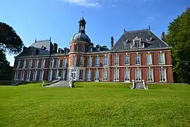 Château | |
Location of Le Landin | |
 Le Landin  Le Landin | |
| Coordinates: 49°24′11″N 0°47′58″E / 49.4031°N 0.7994°E | |
| Country | France |
| Region | Normandy |
| Department | Eure |
| Arrondissement | Bernay |
| Canton | Bourg-Achard |
| Intercommunality | Roumois Seine |
| Government | |
| • Mayor (2020–2026) | Michel Dezellus[1] |
| Area 1 | 3.15 km2 (1.22 sq mi) |
| Population | 244 |
| • Density | 77/km2 (200/sq mi) |
| Time zone | UTC+01:00 (CET) |
| • Summer (DST) | UTC+02:00 (CEST) |
| INSEE/Postal code | 27363 /27350 |
| Elevation | 1–144 m (3.3–472.4 ft) (avg. 144 m or 472 ft) |
| 1 French Land Register data, which excludes lakes, ponds, glaciers > 1 km2 (0.386 sq mi or 247 acres) and river estuaries. | |
Le Landin (French pronunciation: [lə lɑ̃dɛ̃]) is a commune in the Eure department in Normandy in north-western France.
Population
| Year | Pop. | ±% p.a. |
|---|---|---|
| 1968 | 108 | — |
| 1975 | 96 | −1.67% |
| 1982 | 103 | +1.01% |
| 1990 | 160 | +5.66% |
| 1999 | 151 | −0.64% |
| 2007 | 167 | +1.27% |
| 2012 | 188 | +2.40% |
| 2017 | 209 | +2.14% |
| Source: INSEE[3] | ||
See also
References
- ↑ "Répertoire national des élus: les maires". data.gouv.fr, Plateforme ouverte des données publiques françaises (in French). 2 December 2020.
- ↑ "Populations légales 2021". The National Institute of Statistics and Economic Studies. 28 December 2023.
- ↑ Population en historique depuis 1968, INSEE
Wikimedia Commons has media related to Le Landin.
This article is issued from Wikipedia. The text is licensed under Creative Commons - Attribution - Sharealike. Additional terms may apply for the media files.