Herrera del Duque | |
|---|---|
 Flag  Coat of arms | |
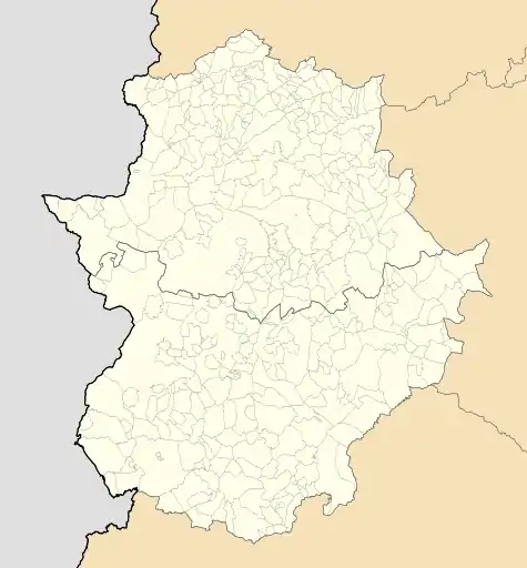 Herrera del Duque Location of Herrera del Duque within Extremadura | |
| Coordinates: 39°10′7″N 5°3′4″W / 39.16861°N 5.05111°W | |
| Country | Spain |
| Autonomous community | Extremadura |
| Province | Badajoz |
| Comarca | La Siberia |
| Government | |
| • Mayor | Saturnino Alcázar Vaquerizo |
| Area | |
| • Total | 277.3 km2 (107.1 sq mi) |
| Elevation | 468 m (1,535 ft) |
| Population (2018)[1] | |
| • Total | 3,485 |
| • Density | 13/km2 (33/sq mi) |
| Demonym | Herrereños |
| Time zone | UTC+1 (CET) |
| • Summer (DST) | UTC+2 (CEST) |
| Postal code. | 06670 |
| Website | Official website |
Herrera del Duque (Extremaduran: Herrera del Duqui) is a municipality located in the province of Badajoz, Extremadura, Spain. As of 2010, the municipality has a population of 3681 inhabitants.[2]
The town is commanded by a 15th-16th-century fortress-castle. Other sights include the church of St. John the Baptist and the hermitage of Nuestra Señora de Consolación.
Villages
The municipality includes the village of Peloche, located at 8 km from the town, with a population of 235 inhabitants according to the 2009 census.[3]
Sights
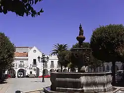 Plaza de España in Herrera del Duque |
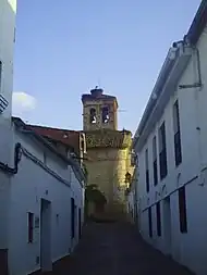 Church tower in Herrera del Duque |
.jpg.webp) San Antón celebrations in Peloche |
References
- ↑ Municipal Register of Spain 2018. National Statistics Institute.
- ↑ INE
- ↑ Instituto Nacional de Estadística (INE)
External links
This article is issued from Wikipedia. The text is licensed under Creative Commons - Attribution - Sharealike. Additional terms may apply for the media files.