Iguerande | |
|---|---|
-20110330.jpg.webp) The church in Iguerande | |
Location of Iguerande | |
 Iguerande  Iguerande | |
| Coordinates: 46°12′22″N 4°04′46″E / 46.2061°N 4.0794°E | |
| Country | France |
| Region | Bourgogne-Franche-Comté |
| Department | Saône-et-Loire |
| Arrondissement | Charolles |
| Canton | Chauffailles |
| Area 1 | 21.43 km2 (8.27 sq mi) |
| Population | 996 |
| • Density | 46/km2 (120/sq mi) |
| Time zone | UTC+01:00 (CET) |
| • Summer (DST) | UTC+02:00 (CEST) |
| INSEE/Postal code | 71238 /71340 |
| Elevation | 245–425 m (804–1,394 ft) (avg. 300 m or 980 ft) |
| 1 French Land Register data, which excludes lakes, ponds, glaciers > 1 km2 (0.386 sq mi or 247 acres) and river estuaries. | |
Iguerande (French pronunciation: [iɡʁɑ̃d]) is a commune in the Saône-et-Loire department in the region of Bourgogne-Franche-Comté in eastern France.
See also
References
- ↑ "Populations légales 2021". The National Institute of Statistics and Economic Studies. 28 December 2023.
Gallery
- Parish church Saint Marcel
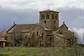 St Marcel's church.
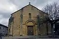 Forecourt view.
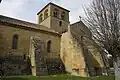 Buttres.
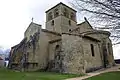 Bells tower.
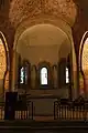 Oven bottom apse.
 Saint with phylactery.
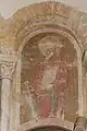 Saint Paul.
Wikimedia Commons has media related to Iguerande.
This article is issued from Wikipedia. The text is licensed under Creative Commons - Attribution - Sharealike. Additional terms may apply for the media files.