L'Hôpital-le-Mercier | |
|---|---|
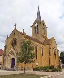 The church in L'Hôpital-le-Mercier | |
Location of L'Hôpital-le-Mercier | |
 L'Hôpital-le-Mercier  L'Hôpital-le-Mercier | |
| Coordinates: 46°23′34″N 4°00′56″E / 46.3928°N 4.0156°E | |
| Country | France |
| Region | Bourgogne-Franche-Comté |
| Department | Saône-et-Loire |
| Arrondissement | Charolles |
| Canton | Paray-le-Monial |
| Area 1 | 16.47 km2 (6.36 sq mi) |
| Population | 301 |
| • Density | 18/km2 (47/sq mi) |
| Time zone | UTC+01:00 (CET) |
| • Summer (DST) | UTC+02:00 (CEST) |
| INSEE/Postal code | 71233 /71600 |
| Elevation | 229–256 m (751–840 ft) (avg. 241 m or 791 ft) |
| 1 French Land Register data, which excludes lakes, ponds, glaciers > 1 km2 (0.386 sq mi or 247 acres) and river estuaries. | |
L'Hôpital-le-Mercier (French pronunciation: [lopital lə mɛʁsje]) is a commune in the Saône-et-Loire department in the region of Bourgogne-Franche-Comté in eastern France.
Geography
The Arconce forms most of the commune's eastern border and the Loire parts of its western border.
See also
References
- ↑ "Populations légales 2021". The National Institute of Statistics and Economic Studies. 28 December 2023.
Wikimedia Commons has media related to L'Hôpital-le-Mercier.
This article is issued from Wikipedia. The text is licensed under Creative Commons - Attribution - Sharealike. Additional terms may apply for the media files.