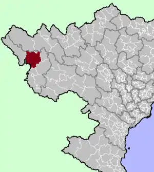
Mường Chà District
Huyện Mường Chà | |
|---|---|
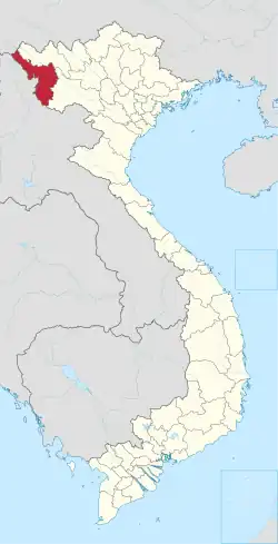
 Mường Chà district location in northern Vietnam | |
| Country | |
| Region | Northwest |
| Province | Điện Biên |
| Capital | Mường Chà |
| Area | |
| • Total | 463.10 sq mi (1,199.42 km2) |
| Population (2012) | |
| • Total | 39,456 |
| • Density | 90/sq mi (33/km2) |
| Time zone | UTC+7 (Indochina Time) |
Mường Chà is a rural district of Điện Biên province in the Northwest region of Vietnam. As of 2012 the district had a population of 39,456.[1] The district covers an area of 1,199.42 km². The district capital lies at Mường Chà.[1]
On 25 August 2012, the western portion of the district was carved out to form Nậm Pồ district.
Geography
Administrative divisions
Mường Chà has 12 administrative units, including 1 town and 11 communes:
- Mường Chà town
- Huổi Lèng
- Huổi Mí
- Hừa Ngài
- Ma Thì Hồ
- Mường Mươn
- Mường Tùng
- Na Sang
- Nậm Nèn
- Pa Ham
- Sa Lông
- Sá Tổng
References
- 1 2 "Districts of Vietnam". Statoids. Retrieved 13 March 2009.
Capital: Điện Biên Phủ | ||
| Điện Biên Phủ |
|  |
| Mường Lay | ||
| Điện Biên |
| |
| Điện Biên Đông | ||
| Mường Ảng |
| |
| Mường Chà |
| |
| Mường Nhé | ||
| Nậm Pồ | ||
| Tủa Chùa | ||
| Tuần Giáo |
| |
| Điện Biên province | 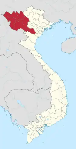 | |
|---|---|---|
| Hòa Bình province | ||
| Lai Châu province | ||
| Lào Cai province | ||
| Sơn La province | ||
| Yên Bái province | ||
※ denotes provincial seat. | ||
21°43′40″N 103°04′49″E / 21.72778°N 103.08028°E
This article is issued from Wikipedia. The text is licensed under Creative Commons - Attribution - Sharealike. Additional terms may apply for the media files.