Mellé
| |
|---|---|
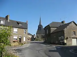 The village of Mellé | |
Location of Mellé | |
 Mellé  Mellé | |
| Coordinates: 48°29′20″N 1°11′15″W / 48.4889°N 1.1875°W | |
| Country | France |
| Region | Brittany |
| Department | Ille-et-Vilaine |
| Arrondissement | Fougères-Vitré |
| Canton | Fougères-2 |
| Intercommunality | Fougères Agglomération |
| Government | |
| • Mayor (2020–2026) | Olivier Poste[1] |
| Area 1 | 15.50 km2 (5.98 sq mi) |
| Population | 649 |
| • Density | 42/km2 (110/sq mi) |
| Time zone | UTC+01:00 (CET) |
| • Summer (DST) | UTC+02:00 (CEST) |
| INSEE/Postal code | 35174 /35420 |
| Elevation | 129–196 m (423–643 ft) |
| 1 French Land Register data, which excludes lakes, ponds, glaciers > 1 km2 (0.386 sq mi or 247 acres) and river estuaries. | |
Mellé (French pronunciation: [mɛle]; Gallo: Mèlae, Breton: Melleg) is a commune in the Ille-et-Vilaine department in Brittany in northwestern France. It is about 50 km northeast of Rennes.
Population
Inhabitants of Mellé are called Melléens in French.
| Year | Pop. | ±% |
|---|---|---|
| 1962 | 810 | — |
| 1968 | 885 | +9.3% |
| 1975 | 806 | −8.9% |
| 1982 | 738 | −8.4% |
| 1990 | 706 | −4.3% |
| 1999 | 678 | −4.0% |
| 2008 | 667 | −1.6% |
See also
References
- ↑ "Répertoire national des élus: les maires" (in French). data.gouv.fr, Plateforme ouverte des données publiques françaises. 13 September 2022.
- ↑ "Populations légales 2021". The National Institute of Statistics and Economic Studies. 28 December 2023.
External links
Wikimedia Commons has media related to Mellé.
- Base Mérimée: Search for heritage in the commune, Ministère français de la Culture. (in French)
- Mayors of Ille-et-Vilaine Association (in French)
This article is issued from Wikipedia. The text is licensed under Creative Commons - Attribution - Sharealike. Additional terms may apply for the media files.