Saint-Séglin
| |
|---|---|
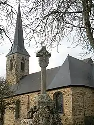 Church and calvary of Saint-Séglin | |
Location of Saint-Séglin | |
 Saint-Séglin  Saint-Séglin | |
| Coordinates: 47°51′15″N 2°00′12″W / 47.8542°N 2.0033°W | |
| Country | France |
| Region | Brittany |
| Department | Ille-et-Vilaine |
| Arrondissement | Redon |
| Canton | Guichen |
| Government | |
| • Mayor (2020–2026) | Marie Monvoisin[1] |
| Area 1 | 9.40 km2 (3.63 sq mi) |
| Population | 590 |
| • Density | 63/km2 (160/sq mi) |
| Time zone | UTC+01:00 (CET) |
| • Summer (DST) | UTC+02:00 (CEST) |
| INSEE/Postal code | 35311 /35330 |
| Elevation | 12–74 m (39–243 ft) |
| 1 French Land Register data, which excludes lakes, ponds, glaciers > 1 km2 (0.386 sq mi or 247 acres) and river estuaries. | |
Saint-Séglin (French pronunciation: [sɛ̃ seɡlɛ̃]; Breton: Sant-Sewenn; Gallo: Saent-Segelein) is a commune in the Ille-et-Vilaine department in Brittany in northwestern France.
Population
Inhabitants of Saint-Séglin are called Séglinois in French.
| Year | Pop. | ±% |
|---|---|---|
| 1962 | 465 | — |
| 1968 | 512 | +10.1% |
| 1975 | 495 | −3.3% |
| 1982 | 411 | −17.0% |
| 1990 | 409 | −0.5% |
| 1999 | 433 | +5.9% |
| 2009 | 468 | +8.1% |
See also
References
- ↑ "Répertoire national des élus: les maires". data.gouv.fr, Plateforme ouverte des données publiques françaises (in French). 2 December 2020.
- ↑ "Populations légales 2021". The National Institute of Statistics and Economic Studies. 28 December 2023.
External links
Wikimedia Commons has media related to Saint-Séglin.
- Base Mérimée: Search for heritage in the commune, Ministère français de la Culture. (in French)
- Mayors of Ille-et-Vilaine Association (in French)
This article is issued from Wikipedia. The text is licensed under Creative Commons - Attribution - Sharealike. Additional terms may apply for the media files.