| Mount Bess | |
|---|---|
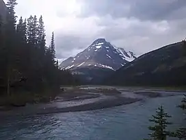 Mount Bess viewed from Chown Creek | |
| Highest point | |
| Elevation | 3,203 m (10,509 ft)[1] |
| Prominence | 618 m (2,028 ft)[2] |
| Parent peak | Mount Chown (3316 m)[2] |
| Listing | |
| Coordinates | 53°20′59″N 119°22′38″W / 53.34972°N 119.37722°W[3] |
| Geography | |
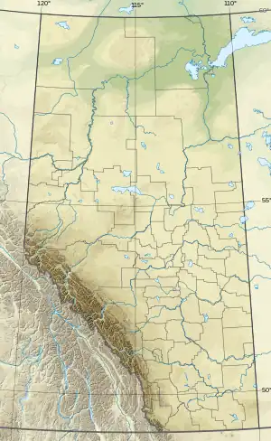 Mount Bess Location in Alberta and British Columbia 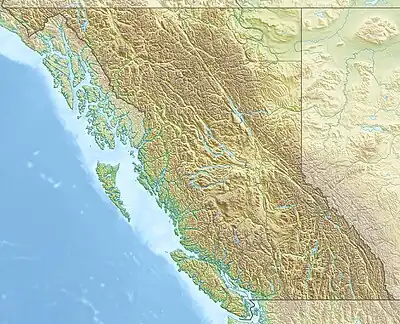 Mount Bess Mount Bess (British Columbia) | |
| Country | Canada |
| Provinces | Alberta and British Columbia |
| Parent range | Front Ranges |
| Topo map | NTS 83E6 Twintree Lake[3] |
| Climbing | |
| First ascent | 1911 by J. Norman Collie, A.L. Mumm, J. Yates[1] |
Mount Bess is located on the border of Alberta and British Columbia.[4] It is the 83rd highest peak in Alberta. It was named in 1910 by J. Norman Collie after Bessie Gunn, who accompanied Collie's expedition.[1][2][5][6]
See also
References
- 1 2 3 "Mount Bess". cdnrockiesdatabases.ca. Retrieved 2019-08-20.
- 1 2 3 "Mount Bess". Bivouac.com. Retrieved 2021-07-11.
- 1 2 "Mount Bess (Alberta)". Geographical Names Data Base. Natural Resources Canada. Retrieved 2021-07-11.
- ↑ "Mount Bess". BC Geographical Names. Retrieved 2021-07-11.
- ↑ Boles, Glen W.; Laurilla, Roger W.; Putnam, William L. (2006). Canadian Mountain Place Names. Vancouver: Rocky Mountain Books. p. 42. ISBN 978-1-894765-79-4.
- ↑ Place-names of Alberta. Ottawa: Geographic Board of Canada. 1928. p. 19.
This article is issued from Wikipedia. The text is licensed under Creative Commons - Attribution - Sharealike. Additional terms may apply for the media files.