Noiraigue | |
|---|---|
 Coat of arms | |
Location of Noiraigue | |
 Noiraigue 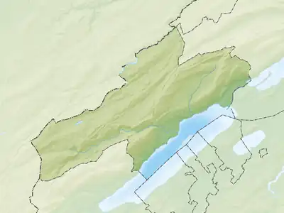 Noiraigue | |
| Coordinates: 46°57′N 6°43′E / 46.950°N 6.717°E | |
| Country | Switzerland |
| Canton | Neuchâtel |
| District | Val-de-Travers |
| Area | |
| • Total | 6.38 km2 (2.46 sq mi) |
| Elevation | 729 m (2,392 ft) |
| Population (December 2007) | |
| • Total | 506 |
| • Density | 79/km2 (210/sq mi) |
| Time zone | UTC+01:00 (Central European Time) |
| • Summer (DST) | UTC+02:00 (Central European Summer Time) |
| Postal code(s) | 2103 |
| SFOS number | 6508 |
| Surrounded by | Boudry, Brot-Dessous, Brot-Plamboz, Gorgier, Travers |
| Website | SFSO statistics |
Noiraigue or Noiraigue-Les Œillons was a municipality in the district of Val-de-Travers in the canton of Neuchâtel in Switzerland. On 1 January 2009, the former municipalities of Boveresse, Buttes, Couvet, Fleurier, Les Bayards, Môtiers, Noiraigue, Saint-Sulpice and Travers merged to form Val-de-Travers.[1]
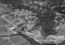
Aerial view (1964)
References
- ↑ Amtliches Gemeindeverzeichnis der Schweiz published by the Swiss Federal Statistical Office (in German) accessed 14 January 2010
This article is issued from Wikipedia. The text is licensed under Creative Commons - Attribution - Sharealike. Additional terms may apply for the media files.