| Ongarue River | |
|---|---|
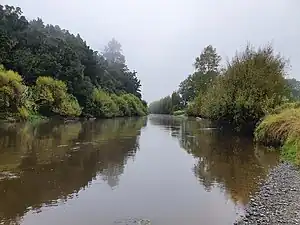 The Ongarue River near the mouth at Taumarunui | |
| Etymology | Māori meaning "place of shaking" |
| Native name | Ōngarue (Māori) |
| Location | |
| Country | New Zealand |
| Region | Manawatū-Whanganui |
| Towns | Taumarunui |
| Settlements | Ongarue, Waimiha |
| Physical characteristics | |
| Source | Hauhungaroa Range |
| • location | Pureora |
| • coordinates | 38°33′14″S 175°37′48″E / 38.55389°S 175.63000°E |
| • elevation | 1,100 m (3,600 ft) |
| Mouth | Whanganui River |
• location | Taumarunui |
• coordinates | 38°53′31″S 175°15′11″E / 38.89194°S 175.25306°E |
• elevation | 144 m (472 ft) |
| Length | 73 km (45 mi) |
| Basin features | |
| Progression | Ongarue River → Whanganui River |
| River system | Whanganui River |
| Tributaries | |
| • left | Maramataha River, Taringamotu River |
| Waterfalls | Wilton Falls, Kawauariki Falls |
The Ongarue River is a river of the Waikato and Manawatū-Whanganui regions of New Zealand's North Island.[1] A major tributary of the Whanganui River, it flows west then south from its sources in the Hauhungaroa Range northwest of Lake Taupō, passing through the town of Taumarunui before reaching the Whanganui River.
Tributaries of the Ongarue include the Maramataha River and the Mangakahu River
See also
References
- ↑ "Place name detail: Ongarue River". New Zealand Gazetteer. New Zealand Geographic Board. Retrieved 18 March 2018.
This article is issued from Wikipedia. The text is licensed under Creative Commons - Attribution - Sharealike. Additional terms may apply for the media files.