Peggau | |
|---|---|
 | |
 Coat of arms | |
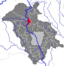 Location within Graz-Umgebung district | |
 Peggau Location within Austria | |
| Coordinates: 47°12′23″N 15°20′39″E / 47.20639°N 15.34417°E | |
| Country | Austria |
| State | Styria |
| District | Graz-Umgebung |
| Government | |
| • Mayor | OAR Werner Rois (Heimatliste) |
| Area | |
| • Total | 11.21 km2 (4.33 sq mi) |
| Elevation | 410 m (1,350 ft) |
| Population (2018-01-01)[2] | |
| • Total | 2,199 |
| • Density | 200/km2 (510/sq mi) |
| Time zone | UTC+1 (CET) |
| • Summer (DST) | UTC+2 (CEST) |
| Postal code | 8120 |
| Area code | 03127 |
| Vehicle registration | GU |
| Website | www.peggau. steiermark.at |
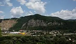
Peggau is a municipality in the district of Graz-Umgebung in the Austrian state of Styria.
Population
| Year | Pop. | ±% |
|---|---|---|
| 1869 | 669 | — |
| 1880 | 753 | +12.6% |
| 1890 | 809 | +7.4% |
| 1900 | 806 | −0.4% |
| 1910 | 1,026 | +27.3% |
| 1923 | 1,183 | +15.3% |
| 1934 | 1,163 | −1.7% |
| 1939 | 1,119 | −3.8% |
| 1951 | 1,536 | +37.3% |
| 1961 | 1,713 | +11.5% |
| 1971 | 1,918 | +12.0% |
| 1981 | 1,966 | +2.5% |
| 1991 | 2,063 | +4.9% |
| 2001 | 2,171 | +5.2% |
References
- ↑ "Dauersiedlungsraum der Gemeinden Politischen Bezirke und Bundesländer - Gebietsstand 1.1.2018". Statistics Austria. Retrieved 10 March 2019.
- ↑ "Einwohnerzahl 1.1.2018 nach Gemeinden mit Status, Gebietsstand 1.1.2018". Statistics Austria. Retrieved 9 March 2019.
This article is issued from Wikipedia. The text is licensed under Creative Commons - Attribution - Sharealike. Additional terms may apply for the media files.