Peyrabout | |
|---|---|
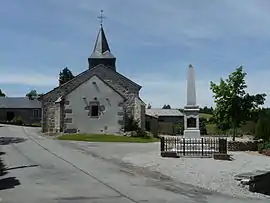 A view of the church and the war memorial in Peyrabout | |
Location of Peyrabout | |
 Peyrabout  Peyrabout | |
| Coordinates: 46°06′29″N 1°54′46″E / 46.1081°N 1.9128°E | |
| Country | France |
| Region | Nouvelle-Aquitaine |
| Department | Creuse |
| Arrondissement | Guéret |
| Canton | Ahun |
| Intercommunality | CA Grand Guéret |
| Government | |
| • Mayor (2020–2026) | Jean-Paul Brignoli[1] |
| Area 1 | 8.91 km2 (3.44 sq mi) |
| Population | 153 |
| • Density | 17/km2 (44/sq mi) |
| Time zone | UTC+01:00 (CET) |
| • Summer (DST) | UTC+02:00 (CEST) |
| INSEE/Postal code | 23150 /23000 |
| Elevation | 446–685 m (1,463–2,247 ft) (avg. 600 m or 2,000 ft) |
| 1 French Land Register data, which excludes lakes, ponds, glaciers > 1 km2 (0.386 sq mi or 247 acres) and river estuaries. | |
Peyrabout (French pronunciation: [pɛʁabu]; Occitan: Peirabon) is a commune in the Creuse department in the Nouvelle-Aquitaine region in central France.[3]
Geography
A small area of forestry and farming comprising the village and one hamlet situated just 5 miles (8.0 km) south of Guéret, at the junction of the D3 and the D52.
Population
| Year | Pop. | ±% |
|---|---|---|
| 1962 | 83 | — |
| 1968 | 111 | +33.7% |
| 1975 | 114 | +2.7% |
| 1982 | 171 | +50.0% |
| 1990 | 162 | −5.3% |
| 1999 | 158 | −2.5% |
| 2008 | 140 | −11.4% |
Sights
- The church of St. Madeleine, dating from the twelfth century.
See also
References
- ↑ "Répertoire national des élus: les maires" (in French). data.gouv.fr, Plateforme ouverte des données publiques françaises. 13 September 2022.
- ↑ "Populations légales 2021". The National Institute of Statistics and Economic Studies. 28 December 2023.
- ↑ Commune de Peyrabout (23150), INSEE
Wikimedia Commons has media related to Peyrabout.
This article is issued from Wikipedia. The text is licensed under Creative Commons - Attribution - Sharealike. Additional terms may apply for the media files.