Saint-Vaury | |
|---|---|
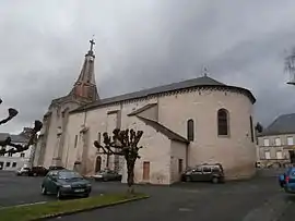 The church in Saint-Vaury | |
.svg.png.webp) Coat of arms | |
Location of Saint-Vaury | |
 Saint-Vaury  Saint-Vaury | |
| Coordinates: 46°12′16″N 1°45′24″E / 46.2044°N 1.7567°E | |
| Country | France |
| Region | Nouvelle-Aquitaine |
| Department | Creuse |
| Arrondissement | Guéret |
| Canton | Saint-Vaury |
| Intercommunality | CA Grand Guéret |
| Government | |
| • Mayor (2020–2026) | Philippe Bayol[1] |
| Area 1 | 46.5 km2 (18.0 sq mi) |
| Population | 1,732 |
| • Density | 37/km2 (96/sq mi) |
| Time zone | UTC+01:00 (CET) |
| • Summer (DST) | UTC+02:00 (CEST) |
| INSEE/Postal code | 23247 /23320 |
| Elevation | 387–634 m (1,270–2,080 ft) (avg. 458 m or 1,503 ft) |
| 1 French Land Register data, which excludes lakes, ponds, glaciers > 1 km2 (0.386 sq mi or 247 acres) and river estuaries. | |
Saint-Vaury (French pronunciation: [sɛ̃ voʁi]; Occitan: Sent Vauric) is a commune in the Creuse department in central France.
Population
| Year | Pop. | ±% |
|---|---|---|
| 1962 | 1,970 | — |
| 1968 | 2,359 | +19.7% |
| 1975 | 2,322 | −1.6% |
| 1982 | 2,265 | −2.5% |
| 1990 | 2,059 | −9.1% |
| 1999 | 1,829 | −11.2% |
| 2008 | 1,861 | +1.7% |
See also
References
- ↑ "Répertoire national des élus: les maires". data.gouv.fr, Plateforme ouverte des données publiques françaises (in French). 2 December 2020.
- ↑ "Populations légales 2021". The National Institute of Statistics and Economic Studies. 28 December 2023.
Wikimedia Commons has media related to Saint-Vaury.
This article is issued from Wikipedia. The text is licensed under Creative Commons - Attribution - Sharealike. Additional terms may apply for the media files.