Pilisszántó
Santov | |
|---|---|
Village | |
 | |
 Flag  Coat of arms | |
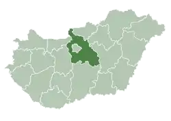
 Pilisszántó Location of Pilisszántó | |
| Coordinates: 47°40′11″N 18°53′12″E / 47.66979°N 18.88674°E | |
| Country | Hungary |
| Region | Central Hungary |
| County | Pest |
| District | Pilisvörösvár |
| Area | |
| • Total | 15.96 km2 (6.16 sq mi) |
| Population (1 January 2023)[1] | |
| • Total | 2,688 |
| • Density | 170/km2 (440/sq mi) |
| Time zone | UTC+1 (CET) |
| • Summer (DST) | UTC+2 (CEST) |
| Postal code | 2095 |
| Area code | (+36) 26 |
| Website | www |
Pilisszántó (Slovak: Santov) is a village in Pest County, Budapest metropolitan area, Hungary. It has a population of 2,365 (2007).
References
- ↑ Error: Unable to display the reference properly. See the documentation for details.

This article is issued from Wikipedia. The text is licensed under Creative Commons - Attribution - Sharealike. Additional terms may apply for the media files.