 | ||||
|---|---|---|---|---|
| Bóthar R638 | ||||
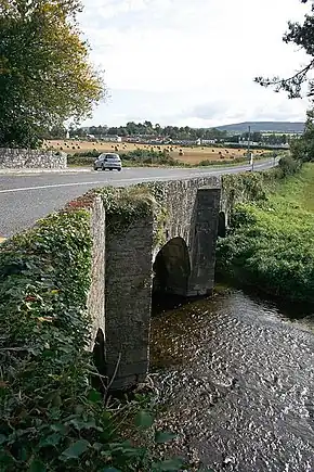 R619 crossing Clyda Bridge; the R619 continues to the left, while the R638 begins straight on. | ||||
| Route information | ||||
| Length | 2.3 km[1] (1.4 mi) | |||
| Major junctions | ||||
| From | ||||
| To | ||||
| Location | ||||
| Country | Ireland | |||
| Highway system | ||||
| ||||
The R638 road is a regional road in northern County Cork, Ireland. It connects the R619 to the N20 south of Mallow.[2][3][4]
References
- ↑ "S.I. No. 54/2012 – Roads Act 1993 (Classification of Regional Roads) Order 2012". Government of Ireland. 28 February 2012. Retrieved 14 November 2020.
- ↑ "Section 38 - Proposed Traffic Calming Works at R638, Merrots Corner, Mallow, Co Cork". www.gov.ie.
- ↑ "Alert Item". mapalerts.corkcoco.ie.
- ↑ "Work continues to progress the Mallow Sewerage Network Upgrade". Uisce Éireann.
This article is issued from Wikipedia. The text is licensed under Creative Commons - Attribution - Sharealike. Additional terms may apply for the media files.