Reiningue | |
|---|---|
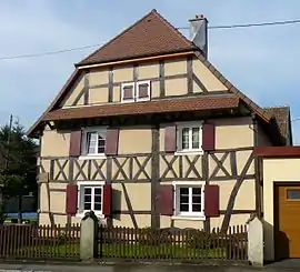 The town hall in Reiningue | |
.svg.png.webp) Coat of arms | |
Location of Reiningue | |
 Reiningue  Reiningue | |
| Coordinates: 47°45′05″N 7°13′56″E / 47.7514°N 7.2322°E | |
| Country | France |
| Region | Grand Est |
| Department | Haut-Rhin |
| Arrondissement | Mulhouse |
| Canton | Kingersheim |
| Intercommunality | Mulhouse Alsace Agglomération |
| Government | |
| • Mayor (2020–2026) | Alain Leconte[1] |
| Area 1 | 18.54 km2 (7.16 sq mi) |
| Population | 1,951 |
| • Density | 110/km2 (270/sq mi) |
| Time zone | UTC+01:00 (CET) |
| • Summer (DST) | UTC+02:00 (CEST) |
| INSEE/Postal code | 68267 /68950 |
| Elevation | 255–297 m (837–974 ft) (avg. 264 m or 866 ft) |
| 1 French Land Register data, which excludes lakes, ponds, glaciers > 1 km2 (0.386 sq mi or 247 acres) and river estuaries. | |
Reiningue (French pronunciation: [ʁɛnɛ̃g] ⓘ; German: Reiningen) is a commune in the Haut-Rhin department in Alsace in north-eastern France. It forms part of the Mulhouse Alsace Agglomération, the inter-communal local government body for the Mulhouse conurbation.[3]
The 11th-century Trappist Oelenberg Abbey is located in Reiningue.
See also
References
- ↑ "Répertoire national des élus: les maires". data.gouv.fr, Plateforme ouverte des données publiques françaises (in French). 2 December 2020.
- ↑ "Populations légales 2021". The National Institute of Statistics and Economic Studies. 28 December 2023.
- ↑ "Mulhouse Alsace Agglomération". Mulhouse Alsace Agglomération. Retrieved 2011-04-07.
Wikimedia Commons has media related to Reiningue.
This article is issued from Wikipedia. The text is licensed under Creative Commons - Attribution - Sharealike. Additional terms may apply for the media files.