Remilly-les-Pothées | |
|---|---|
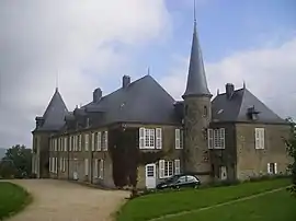 The chateau of Hardoncelle in Remilly-les-Pothées | |
Location of Remilly-les-Pothées | |
 Remilly-les-Pothées  Remilly-les-Pothées | |
| Coordinates: 49°46′55″N 4°31′53″E / 49.7819°N 4.5314°E | |
| Country | France |
| Region | Grand Est |
| Department | Ardennes |
| Arrondissement | Charleville-Mézières |
| Canton | Rocroi |
| Government | |
| • Mayor (2020–2026) | Marc Bertrand[1] |
| Area 1 | 9.92 km2 (3.83 sq mi) |
| Population | 259 |
| • Density | 26/km2 (68/sq mi) |
| Time zone | UTC+01:00 (CET) |
| • Summer (DST) | UTC+02:00 (CEST) |
| INSEE/Postal code | 08358 /08150 |
| 1 French Land Register data, which excludes lakes, ponds, glaciers > 1 km2 (0.386 sq mi or 247 acres) and river estuaries. | |
Remilly-les-Pothées is a commune in the Ardennes department in northern France.
Geography
The Sormonne, with the Audry, one of its tributaries, form the commune's northern border.
Population
| Year | Pop. | ±% |
|---|---|---|
| 1962 | 192 | — |
| 1968 | 199 | +3.6% |
| 1975 | 175 | −12.1% |
| 1982 | 193 | +10.3% |
| 1990 | 211 | +9.3% |
| 1999 | 216 | +2.4% |
| 2008 | 268 | +24.1% |
See also
References
- ↑ "Répertoire national des élus: les maires". data.gouv.fr, Plateforme ouverte des données publiques françaises (in French). 2 December 2020.
- ↑ "Populations légales 2021". The National Institute of Statistics and Economic Studies. 28 December 2023.
Wikimedia Commons has media related to Remilly-les-Pothées.
This article is issued from Wikipedia. The text is licensed under Creative Commons - Attribution - Sharealike. Additional terms may apply for the media files.