Saint-Pierre-à-Arnes | |
|---|---|
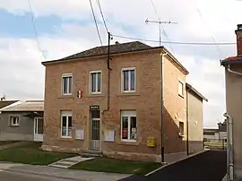 The town hall in Saint-Pierre-à-Arnes | |
Location of Saint-Pierre-à-Arnes | |
 Saint-Pierre-à-Arnes  Saint-Pierre-à-Arnes | |
| Coordinates: 49°18′01″N 4°27′14″E / 49.3003°N 4.4539°E | |
| Country | France |
| Region | Grand Est |
| Department | Ardennes |
| Arrondissement | Vouziers |
| Canton | Attigny |
| Intercommunality | Argonne Ardennaise |
| Government | |
| • Mayor (2020–2026) | Bertrand Haulin[1] |
| Area 1 | 8.41 km2 (3.25 sq mi) |
| Population | 66 |
| • Density | 7.8/km2 (20/sq mi) |
| Time zone | UTC+01:00 (CET) |
| • Summer (DST) | UTC+02:00 (CEST) |
| INSEE/Postal code | 08393 /08310 |
| Elevation | 147–420 m (482–1,378 ft) (avg. 110 m or 360 ft) |
| 1 French Land Register data, which excludes lakes, ponds, glaciers > 1 km2 (0.386 sq mi or 247 acres) and river estuaries. | |
Saint-Pierre-à-Arnes is a commune in the Ardennes department in northern France.
Population
| Year | Pop. | ±% |
|---|---|---|
| 1962 | 82 | — |
| 1968 | 86 | +4.9% |
| 1975 | 77 | −10.5% |
| 1982 | 74 | −3.9% |
| 1990 | 78 | +5.4% |
| 1999 | 69 | −11.5% |
| 2008 | 66 | −4.3% |
See also
References
- ↑ "Répertoire national des élus: les maires". data.gouv.fr, Plateforme ouverte des données publiques françaises (in French). 9 August 2021.
- ↑ "Populations légales 2021". The National Institute of Statistics and Economic Studies. 28 December 2023.
Wikimedia Commons has media related to Saint-Pierre-à-Arnes.
This article is issued from Wikipedia. The text is licensed under Creative Commons - Attribution - Sharealike. Additional terms may apply for the media files.