Sádočné | |
|---|---|
Municipality | |
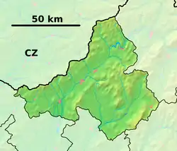 Sádočné Location of Sádočné in the Trenčín Region  Sádočné Sádočné (Slovakia) | |
| Coordinates: 49°01′N 18°33′E / 49.017°N 18.550°E | |
| Country | Slovakia |
| Region | Trenčín |
| District | Považská Bystrica |
| First mentioned | 1339 |
| Area | |
| • Total | 7.505 km2 (2.898 sq mi) |
| Elevation | 420 m (1,380 ft) |
| Population | |
| • Total | 161 |
| • Density | 21/km2 (56/sq mi) |
| Postal code | 018 16 (pošta Domaniža) |
| Area code | 421-42 |
| Car plate | PB |
| Website | sadocne.sk |
Sádočné (Hungarian: Sádecsne) is a village and municipality in Považská Bystrica District in the Trenčín Region of north-western Slovakia.
History
In historical records the village was first mentioned in 1339.
Geography
The municipality lies at an altitude of 420 metres and covers an area of 7.505 km². It has a population of about 161 people.
External links
Municipalities of Považská Bystrica District | ||
|---|---|---|
This article is issued from Wikipedia. The text is licensed under Creative Commons - Attribution - Sharealike. Additional terms may apply for the media files.